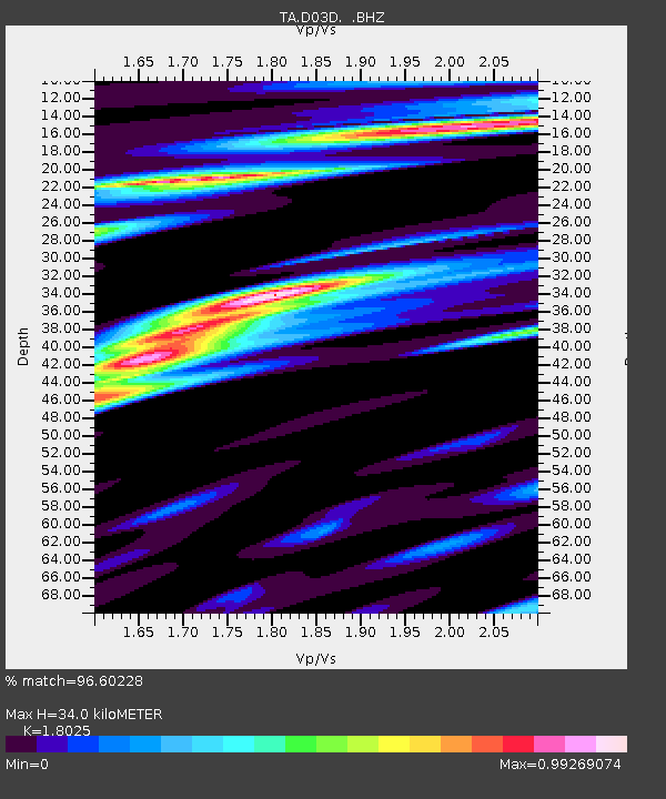
D03D Eldon, WA, USA - Earthquake Result Viewer

Earthquake location: Off East Coast Of Honshu, Japan
Earthquake latitude/longitude: 37.9/143.9
Earthquake time(UTC): 2012/12/07 (342) 08:18:23 GMT
Earthquake Depth: 31 km
Earthquake Magnitude: 7.2 MB, 7.3 MS, 7.3 MW, 7.3 MW
Earthquake Catalog/Contributor: WHDF/NEIC
Network: TA USArray Transportable Network (new EarthScope stations)
Station: D03D Eldon, WA, USA
Lat/Lon: 47.53 N/123.09 W
Elevation: 262 m
Distance: 65.0 deg
Az: 48.284 deg
Baz: 299.359 deg
Ray Param: 0.058488376
Estimated Moho Depth: 34.0 km
Estimated Crust Vp/Vs: 1.80
Assumed Crust Vp: 6.566 km/s
Estimated Crust Vs: 3.643 km/s
Estimated Crust Poisson's Ratio: 0.28
Radial Match: 96.60228 %
Radial Bump: 400
Transverse Match: 96.342804 %
Transverse Bump: 400
SOD ConfigId: 488671
Insert Time: 2013-03-29 04:28:58.470 +0000
GWidth: 2.5
Max Bumps: 400
Tol: 0.001

Signal To Noise

ChannelStoNSTALTA
TA:D03D: :BHZ:20121207T08:28:29.474971Z85.399831.6171922E-51.8936714E-7
TA:D03D: :BHN:20121207T08:28:29.474971Z10.9152082.5310228E-62.318804E-7
TA:D03D: :BHE:20121207T08:28:29.474971Z22.7592334.448948E-61.9547882E-7
Arrivals
Ps4.3 SECOND
PpPs14 SECOND
PsPs/PpSs18 SECOND