
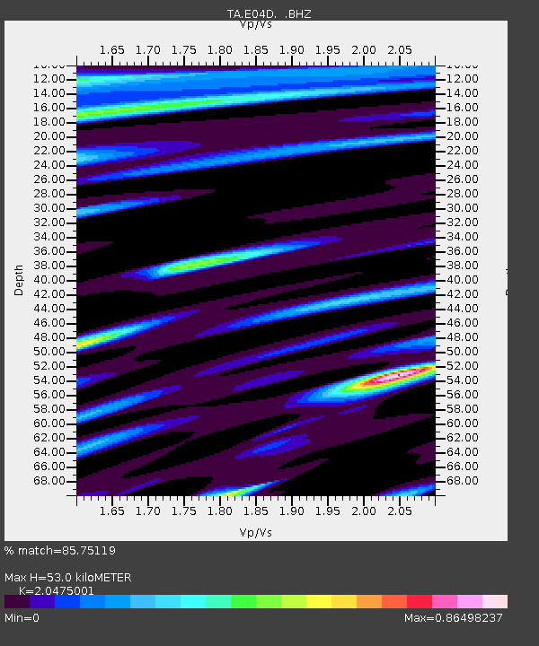
E04D Cinebar, WA, USA - Earthquake Result Viewer
| ||||||||||||||||||
| ||||||||||||||||||
| ||||||||||||||||||
|
Signal To Noise
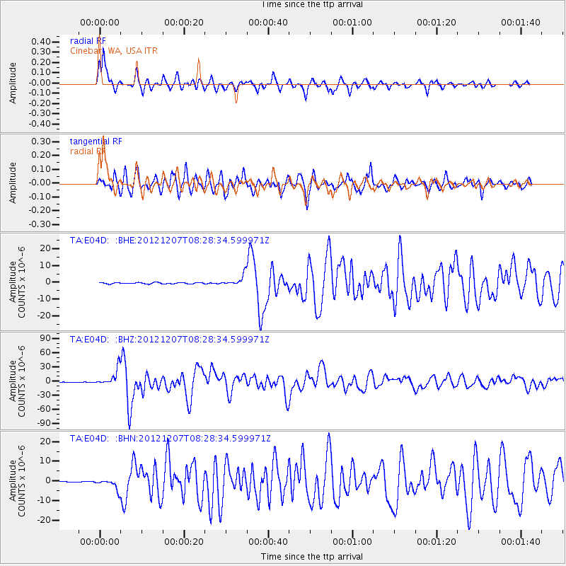
| Channel | StoN | STA | LTA |
| TA:E04D: :BHZ:20121207T08:28:34.599971Z | 65.5339 | 1.823441E-5 | 2.7824393E-7 |
| TA:E04D: :BHN:20121207T08:28:34.599971Z | 9.62076 | 2.8156524E-6 | 2.9266423E-7 |
| TA:E04D: :BHE:20121207T08:28:34.599971Z | 9.289848 | 3.4574125E-6 | 3.7217103E-7 |
| Arrivals | |
| Ps | 8.8 SECOND |
| PpPs | 24 SECOND |
| PsPs/PpSs | 32 SECOND |

