146A Union, MS, USA - Earthquake Result Viewer
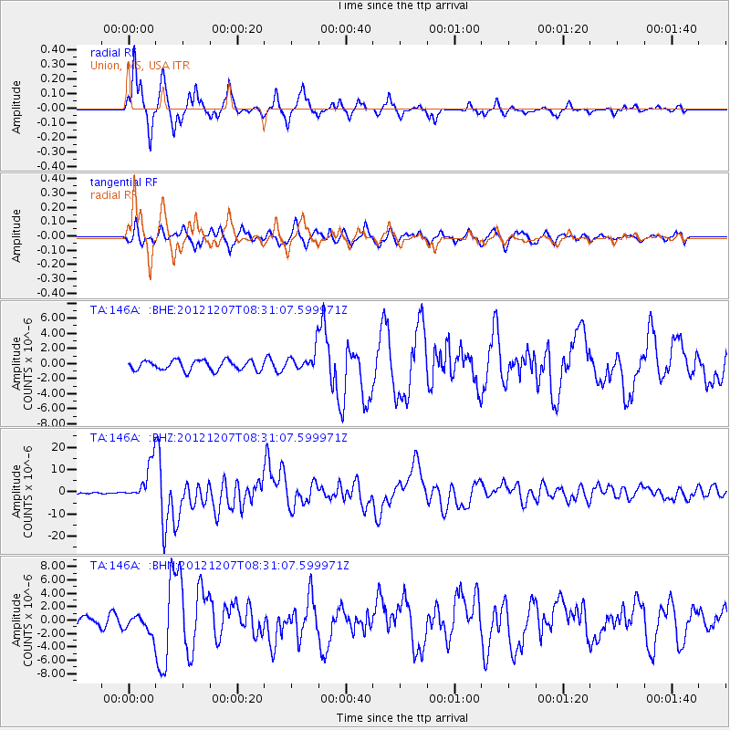
Earthquake location: Off East Coast Of Honshu, Japan
Earthquake latitude/longitude: 37.9/143.9
Earthquake time(UTC): 2012/12/07 (342) 08:18:23 GMT
Earthquake Depth: 31 km
Earthquake Magnitude: 7.2 MB, 7.3 MS, 7.3 MW, 7.3 MW
Earthquake Catalog/Contributor: WHDF/NEIC
Network: TA USArray Transportable Network (new EarthScope stations)
Station: 146A Union, MS, USA
Lat/Lon: 32.64 N/89.06 W
Elevation: 164 m
Distance: 94.2 deg
Az: 42.51 deg
Baz: 320.681 deg
Ray Param: 0.04108501
Estimated Moho Depth: 13.5 km
Estimated Crust Vp/Vs: 1.98
Assumed Crust Vp: 6.201 km/s
Estimated Crust Vs: 3.14 km/s
Estimated Crust Poisson's Ratio: 0.33
Radial Match: 95.86639 %
Radial Bump: 261
Transverse Match: 88.17756 %
Transverse Bump: 400
SOD ConfigId: 488671
Insert Time: 2013-03-29 04:31:34.812 +0000
GWidth: 2.5
Max Bumps: 400
Tol: 0.001

Signal To Noise

ChannelStoNSTALTA
TA:146A: :BHZ:20121207T08:31:07.599971Z24.943838.588137E-63.4429905E-7
TA:146A: :BHN:20121207T08:31:07.599971Z1.59709291.3715904E-68.5880447E-7
TA:146A: :BHE:20121207T08:31:07.599971Z2.24459311.4629346E-66.5175936E-7
Arrivals
Ps2.2 SECOND
PpPs6.4 SECOND
PsPs/PpSs8.5 SECOND