147A Livingston, AL, USA - Earthquake Result Viewer
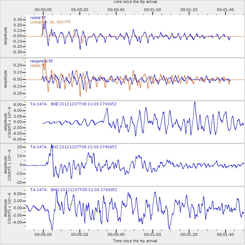
Earthquake location: Off East Coast Of Honshu, Japan
Earthquake latitude/longitude: 37.9/143.9
Earthquake time(UTC): 2012/12/07 (342) 08:18:23 GMT
Earthquake Depth: 31 km
Earthquake Magnitude: 7.2 MB, 7.3 MS, 7.3 MW, 7.3 MW
Earthquake Catalog/Contributor: WHDF/NEIC
Network: TA USArray Transportable Network (new EarthScope stations)
Station: 147A Livingston, AL, USA
Lat/Lon: 32.67 N/88.27 W
Elevation: 57 m
Distance: 94.6 deg
Az: 41.971 deg
Baz: 321.145 deg
Ray Param: 0.040991537
Estimated Moho Depth: 38.25 km
Estimated Crust Vp/Vs: 1.95
Assumed Crust Vp: 6.201 km/s
Estimated Crust Vs: 3.18 km/s
Estimated Crust Poisson's Ratio: 0.32
Radial Match: 91.88298 %
Radial Bump: 400
Transverse Match: 90.83576 %
Transverse Bump: 400
SOD ConfigId: 488671
Insert Time: 2013-03-29 04:32:20.231 +0000
GWidth: 2.5
Max Bumps: 400
Tol: 0.001

Signal To Noise

ChannelStoNSTALTA
TA:147A: :BHZ:20121207T08:31:09.374995Z44.3940779.683222E-62.1811968E-7
TA:147A: :BHN:20121207T08:31:09.374995Z4.48675062.2849604E-65.0926843E-7
TA:147A: :BHE:20121207T08:31:09.374995Z3.06144291.5351794E-65.0145616E-7
Arrivals
Ps6.0 SECOND
PpPs18 SECOND
PsPs/PpSs24 SECOND