
Y46A Houston, MS, USA - Earthquake Result Viewer
| ||||||||||||||||||
| ||||||||||||||||||
| ||||||||||||||||||
|
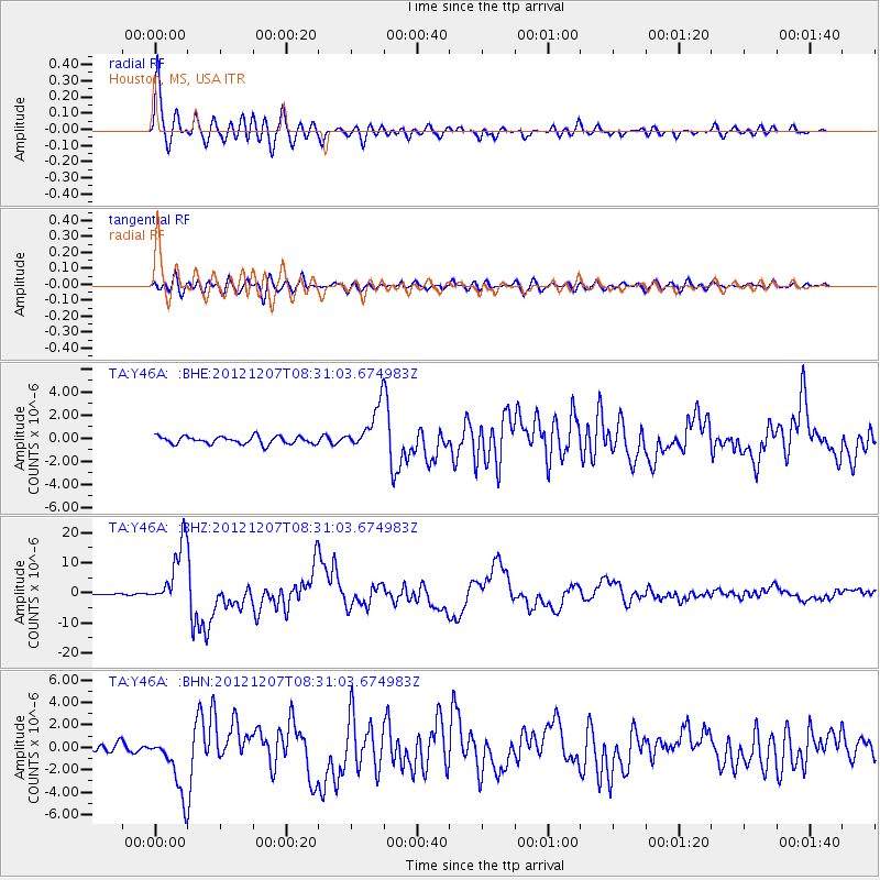
Signal To Noise
| Channel | StoN | STA | LTA |
| TA:Y46A: :BHZ:20121207T08:31:03.674983Z | 51.472538 | 1.0449506E-5 | 2.0301128E-7 |
| TA:Y46A: :BHN:20121207T08:31:03.674983Z | 8.429734 | 2.6991358E-6 | 3.2019227E-7 |
| TA:Y46A: :BHE:20121207T08:31:03.674983Z | 5.8244557 | 1.9153947E-6 | 3.2885387E-7 |
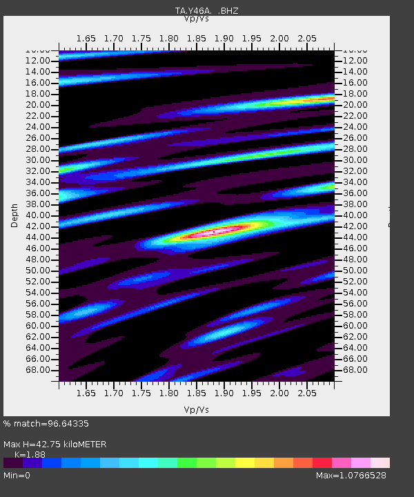
| Arrivals | |
| Ps | 6.2 SECOND |
| PpPs | 20 SECOND |
| PsPs/PpSs | 26 SECOND |

