Z45A Winona, MS, USA - Earthquake Result Viewer
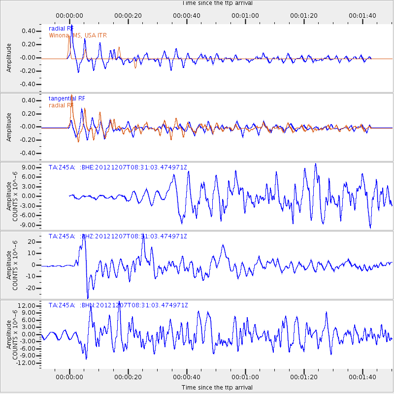
Earthquake location: Off East Coast Of Honshu, Japan
Earthquake latitude/longitude: 37.9/143.9
Earthquake time(UTC): 2012/12/07 (342) 08:18:23 GMT
Earthquake Depth: 31 km
Earthquake Magnitude: 7.2 MB, 7.3 MS, 7.3 MW, 7.3 MW
Earthquake Catalog/Contributor: WHDF/NEIC
Network: TA USArray Transportable Network (new EarthScope stations)
Station: Z45A Winona, MS, USA
Lat/Lon: 33.37 N/89.69 W
Elevation: 113 m
Distance: 93.3 deg
Az: 42.456 deg
Baz: 320.341 deg
Ray Param: 0.041276645
Estimated Moho Depth: 32.0 km
Estimated Crust Vp/Vs: 2.02
Assumed Crust Vp: 6.201 km/s
Estimated Crust Vs: 3.07 km/s
Estimated Crust Poisson's Ratio: 0.34
Radial Match: 92.45637 %
Radial Bump: 400
Transverse Match: 89.043015 %
Transverse Bump: 400
SOD ConfigId: 488671
Insert Time: 2013-03-29 04:32:58.291 +0000
GWidth: 2.5
Max Bumps: 400
Tol: 0.001

Signal To Noise

ChannelStoNSTALTA
TA:Z45A: :BHZ:20121207T08:31:03.474971Z33.1485061.021719E-53.0822474E-7
TA:Z45A: :BHN:20121207T08:31:03.474971Z2.93156892.9356243E-61.0013833E-6
TA:Z45A: :BHE:20121207T08:31:03.474971Z2.83994271.9322829E-66.803951E-7
Arrivals
Ps5.4 SECOND
PpPs15 SECOND
PsPs/PpSs21 SECOND