Y41A Eaglette Bearden, AR, USA - Earthquake Result Viewer
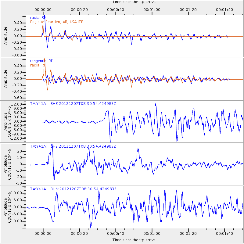
Earthquake location: Off East Coast Of Honshu, Japan
Earthquake latitude/longitude: 37.9/143.9
Earthquake time(UTC): 2012/12/07 (342) 08:18:23 GMT
Earthquake Depth: 31 km
Earthquake Magnitude: 7.2 MB, 7.3 MS, 7.3 MW, 7.3 MW
Earthquake Catalog/Contributor: WHDF/NEIC
Network: TA USArray Transportable Network (new EarthScope stations)
Station: Y41A Eaglette Bearden, AR, USA
Lat/Lon: 33.88 N/92.61 W
Elevation: 99 m
Distance: 91.3 deg
Az: 43.98 deg
Baz: 318.67 deg
Ray Param: 0.04160556
Estimated Moho Depth: 11.5 km
Estimated Crust Vp/Vs: 1.61
Assumed Crust Vp: 6.245 km/s
Estimated Crust Vs: 3.879 km/s
Estimated Crust Poisson's Ratio: 0.19
Radial Match: 95.263885 %
Radial Bump: 400
Transverse Match: 90.97407 %
Transverse Bump: 400
SOD ConfigId: 488671
Insert Time: 2013-03-29 04:33:09.943 +0000
GWidth: 2.5
Max Bumps: 400
Tol: 0.001

Signal To Noise

ChannelStoNSTALTA
TA:Y41A: :BHZ:20121207T08:30:54.424983Z47.2511181.2412432E-52.6269075E-7
TA:Y41A: :BHN:20121207T08:30:54.424983Z5.4942172.6655796E-64.85161E-7
TA:Y41A: :BHE:20121207T08:30:54.424983Z5.20233062.3931377E-64.6001261E-7
Arrivals
Ps1.1 SECOND
PpPs4.7 SECOND
PsPs/PpSs5.9 SECOND