
V42A Cord, AR, USA - Earthquake Result Viewer
| ||||||||||||||||||
| ||||||||||||||||||
| ||||||||||||||||||
|
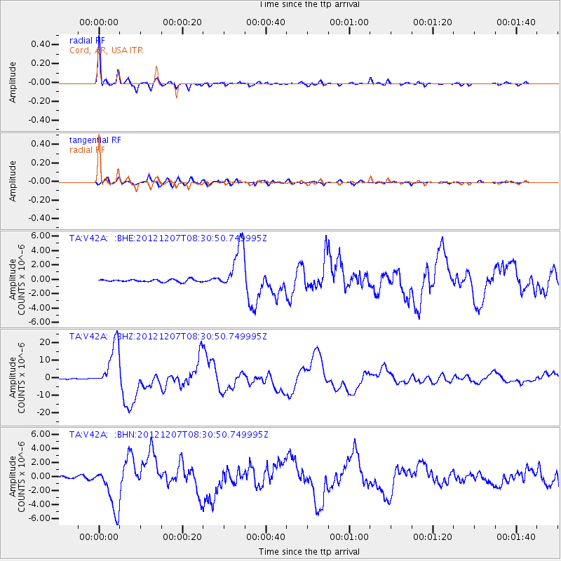
Signal To Noise
| Channel | StoN | STA | LTA |
| TA:V42A: :BHZ:20121207T08:30:50.749995Z | 105.43223 | 1.3252831E-5 | 1.2570001E-7 |
| TA:V42A: :BHN:20121207T08:30:50.749995Z | 24.563057 | 3.3240676E-6 | 1.3532794E-7 |
| TA:V42A: :BHE:20121207T08:30:50.749995Z | 19.604229 | 3.332562E-6 | 1.69992E-7 |
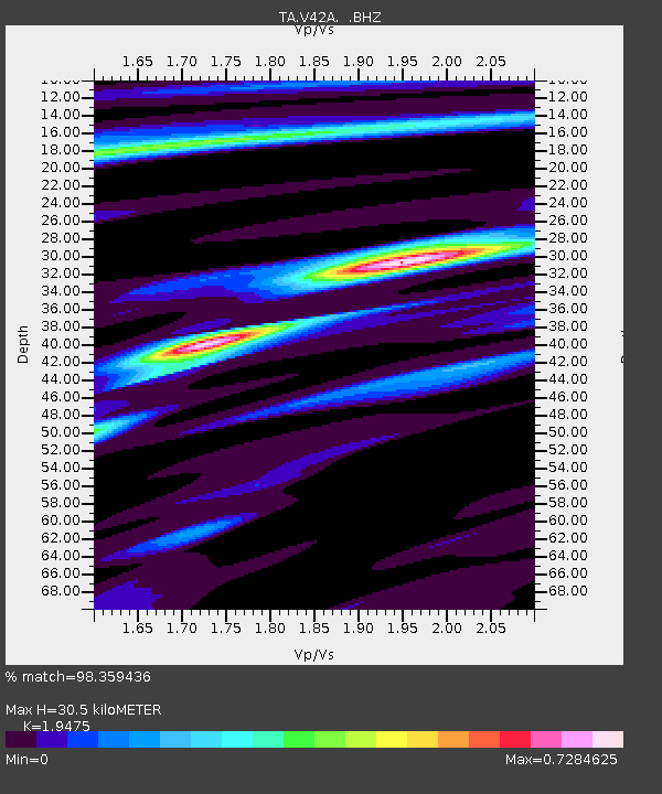
| Arrivals | |
| Ps | 4.7 SECOND |
| PpPs | 14 SECOND |
| PsPs/PpSs | 19 SECOND |

