V45A Humboldt, TN, USA - Earthquake Result Viewer
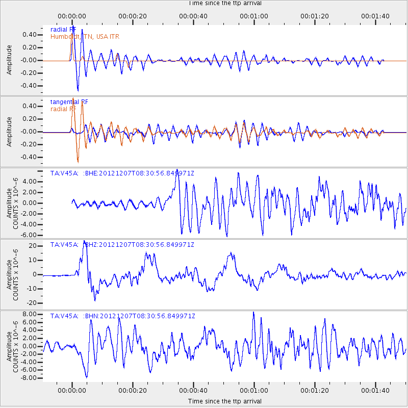
Earthquake location: Off East Coast Of Honshu, Japan
Earthquake latitude/longitude: 37.9/143.9
Earthquake time(UTC): 2012/12/07 (342) 08:18:23 GMT
Earthquake Depth: 31 km
Earthquake Magnitude: 7.2 MB, 7.3 MS, 7.3 MW, 7.3 MW
Earthquake Catalog/Contributor: WHDF/NEIC
Network: TA USArray Transportable Network (new EarthScope stations)
Station: V45A Humboldt, TN, USA
Lat/Lon: 35.74 N/88.96 W
Elevation: 126 m
Distance: 91.9 deg
Az: 40.487 deg
Baz: 320.844 deg
Ray Param: 0.041537482
Estimated Moho Depth: 31.75 km
Estimated Crust Vp/Vs: 1.68
Assumed Crust Vp: 6.38 km/s
Estimated Crust Vs: 3.798 km/s
Estimated Crust Poisson's Ratio: 0.23
Radial Match: 91.48917 %
Radial Bump: 400
Transverse Match: 80.84733 %
Transverse Bump: 400
SOD ConfigId: 488671
Insert Time: 2013-03-29 04:33:56.005 +0000
GWidth: 2.5
Max Bumps: 400
Tol: 0.001

Signal To Noise

ChannelStoNSTALTA
TA:V45A: :BHZ:20121207T08:30:56.849971Z77.039971.1651451E-51.5123904E-7
TA:V45A: :BHN:20121207T08:30:56.849971Z3.76585363.107372E-68.251441E-7
TA:V45A: :BHE:20121207T08:30:56.849971Z6.06209662.6031655E-64.2941673E-7
Arrivals
Ps3.5 SECOND
PpPs13 SECOND
PsPs/PpSs17 SECOND