W45A Hickory Valley, TN, USA - Earthquake Result Viewer
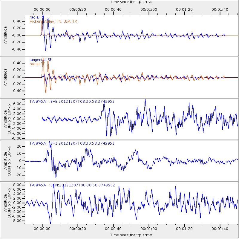
Earthquake location: Off East Coast Of Honshu, Japan
Earthquake latitude/longitude: 37.9/143.9
Earthquake time(UTC): 2012/12/07 (342) 08:18:23 GMT
Earthquake Depth: 31 km
Earthquake Magnitude: 7.2 MB, 7.3 MS, 7.3 MW, 7.3 MW
Earthquake Catalog/Contributor: WHDF/NEIC
Network: TA USArray Transportable Network (new EarthScope stations)
Station: W45A Hickory Valley, TN, USA
Lat/Lon: 35.16 N/89.19 W
Elevation: 187 m
Distance: 92.2 deg
Az: 40.999 deg
Baz: 320.695 deg
Ray Param: 0.04148689
Estimated Moho Depth: 10.0 km
Estimated Crust Vp/Vs: 1.60
Assumed Crust Vp: 6.38 km/s
Estimated Crust Vs: 3.988 km/s
Estimated Crust Poisson's Ratio: 0.18
Radial Match: 95.23829 %
Radial Bump: 400
Transverse Match: 80.486664 %
Transverse Bump: 400
SOD ConfigId: 488671
Insert Time: 2013-03-29 04:34:08.077 +0000
GWidth: 2.5
Max Bumps: 400
Tol: 0.001

Signal To Noise

ChannelStoNSTALTA
TA:W45A: :BHZ:20121207T08:30:58.374995Z50.488421.1614974E-52.3005224E-7
TA:W45A: :BHN:20121207T08:30:58.374995Z5.0503013.5022458E-66.9347266E-7
TA:W45A: :BHE:20121207T08:30:58.374995Z3.74364282.279602E-66.089262E-7
Arrivals
Ps1.0 SECOND
PpPs4.0 SECOND
PsPs/PpSs4.9 SECOND