X43A Marvell, AR, USA - Earthquake Result Viewer
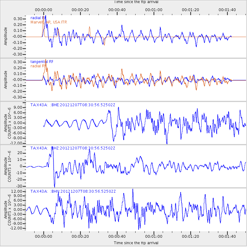
Earthquake location: Off East Coast Of Honshu, Japan
Earthquake latitude/longitude: 37.9/143.9
Earthquake time(UTC): 2012/12/07 (342) 08:18:23 GMT
Earthquake Depth: 31 km
Earthquake Magnitude: 7.2 MB, 7.3 MS, 7.3 MW, 7.3 MW
Earthquake Catalog/Contributor: WHDF/NEIC
Network: TA USArray Transportable Network (new EarthScope stations)
Station: X43A Marvell, AR, USA
Lat/Lon: 34.52 N/90.88 W
Elevation: 53 m
Distance: 91.8 deg
Az: 42.479 deg
Baz: 319.679 deg
Ray Param: 0.04154802
Estimated Moho Depth: 18.25 km
Estimated Crust Vp/Vs: 1.73
Assumed Crust Vp: 6.273 km/s
Estimated Crust Vs: 3.637 km/s
Estimated Crust Poisson's Ratio: 0.25
Radial Match: 88.58334 %
Radial Bump: 400
Transverse Match: 71.205765 %
Transverse Bump: 400
SOD ConfigId: 488671
Insert Time: 2013-03-29 04:34:15.933 +0000
GWidth: 2.5
Max Bumps: 400
Tol: 0.001

Signal To Noise

ChannelStoNSTALTA
TA:X43A: :BHZ:20121207T08:30:56.52502Z15.4156571.24711405E-58.0899184E-7
TA:X43A: :BHN:20121207T08:30:56.52502Z3.74908073.1286959E-68.345235E-7
TA:X43A: :BHE:20121207T08:30:56.52502Z1.13757971.7863823E-61.570336E-6
Arrivals
Ps2.2 SECOND
PpPs7.8 SECOND
PsPs/PpSs9.9 SECOND