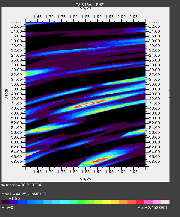
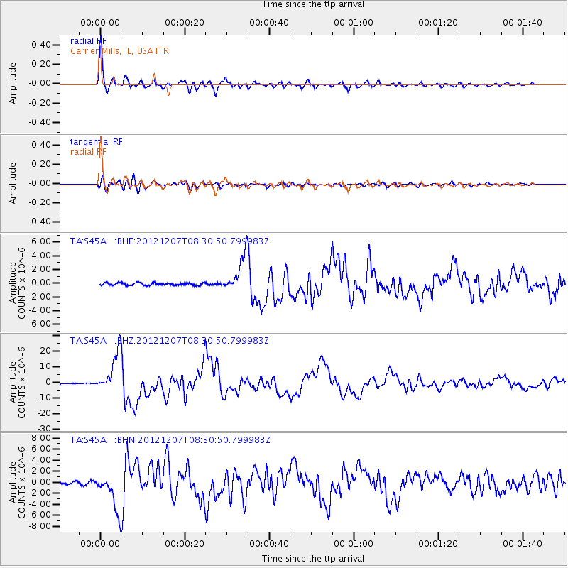
S45A Carrier Mills, IL, USA - Earthquake Result Viewer

Earthquake location: Off East Coast Of Honshu, Japan
Earthquake latitude/longitude: 37.9/143.9
Earthquake time(UTC): 2012/12/07 (342) 08:18:23 GMT
Earthquake Depth: 31 km
Earthquake Magnitude: 7.2 MB, 7.3 MS, 7.3 MW, 7.3 MW
Earthquake Catalog/Contributor: WHDF/NEIC
Network: TA USArray Transportable Network (new EarthScope stations)
Station: S45A Carrier Mills, IL, USA
Lat/Lon: 37.68 N/88.58 W
Elevation: 122 m
Distance: 90.6 deg
Az: 39.032 deg
Baz: 321.1 deg
Ray Param: 0.04166149
Estimated Moho Depth: 44.25 km
Estimated Crust Vp/Vs: 1.85
Assumed Crust Vp: 6.444 km/s
Estimated Crust Vs: 3.483 km/s
Estimated Crust Poisson's Ratio: 0.29
Radial Match: 98.239334 %
Radial Bump: 400
Transverse Match: 89.3719 %
Transverse Bump: 400
SOD ConfigId: 488671
Insert Time: 2013-03-29 04:34:19.439 +0000
GWidth: 2.5
Max Bumps: 400
Tol: 0.001

Signal To Noise

ChannelStoNSTALTA
TA:S45A: :BHZ:20121207T08:30:50.799983Z66.007571.30023745E-51.9698308E-7
TA:S45A: :BHN:20121207T08:30:50.799983Z17.1436713.4421155E-62.0078053E-7
TA:S45A: :BHE:20121207T08:30:50.799983Z15.5676342.7819638E-61.7870178E-7
Arrivals
Ps6.0 SECOND
PpPs19 SECOND
PsPs/PpSs25 SECOND