
Q43A New Douglas, IL, USA - Earthquake Result Viewer
| ||||||||||||||||||
| ||||||||||||||||||
| ||||||||||||||||||
|
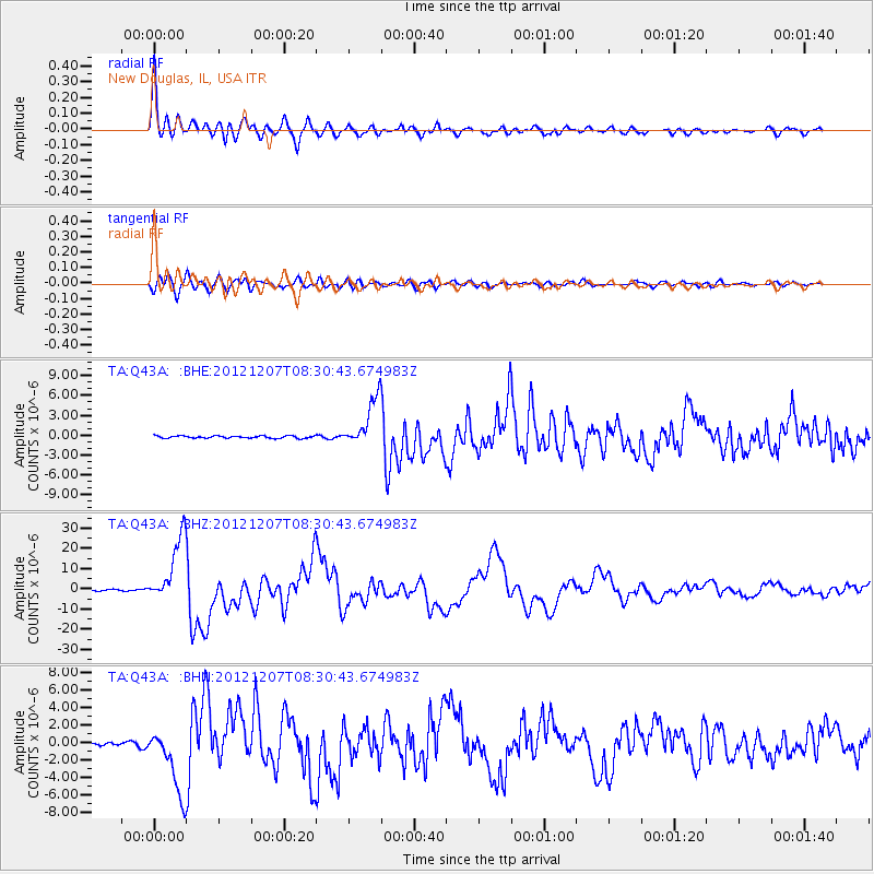
Signal To Noise
| Channel | StoN | STA | LTA |
| TA:Q43A: :BHZ:20121207T08:30:43.674983Z | 67.82484 | 1.629417E-5 | 2.40239E-7 |
| TA:Q43A: :BHN:20121207T08:30:43.674983Z | 16.898777 | 3.7609952E-6 | 2.225602E-7 |
| TA:Q43A: :BHE:20121207T08:30:43.674983Z | 20.445301 | 3.6727668E-6 | 1.7963869E-7 |
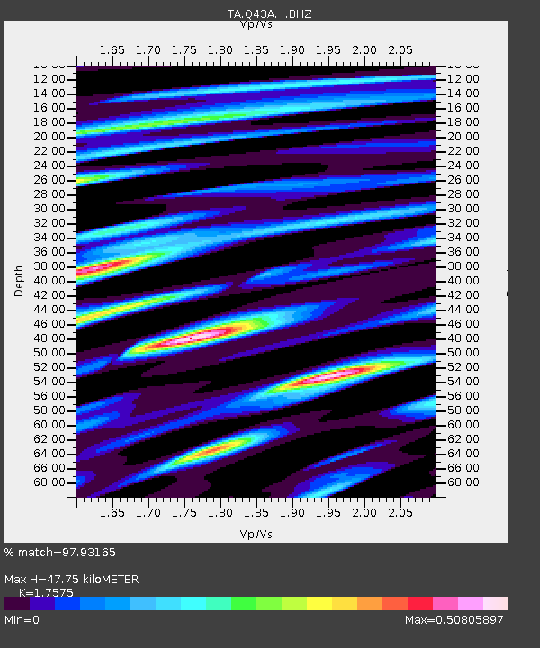
| Arrivals | |
| Ps | 5.7 SECOND |
| PpPs | 20 SECOND |
| PsPs/PpSs | 26 SECOND |

