
K39A Oelwein, IA, USA - Earthquake Result Viewer
| ||||||||||||||||||
| ||||||||||||||||||
| ||||||||||||||||||
|
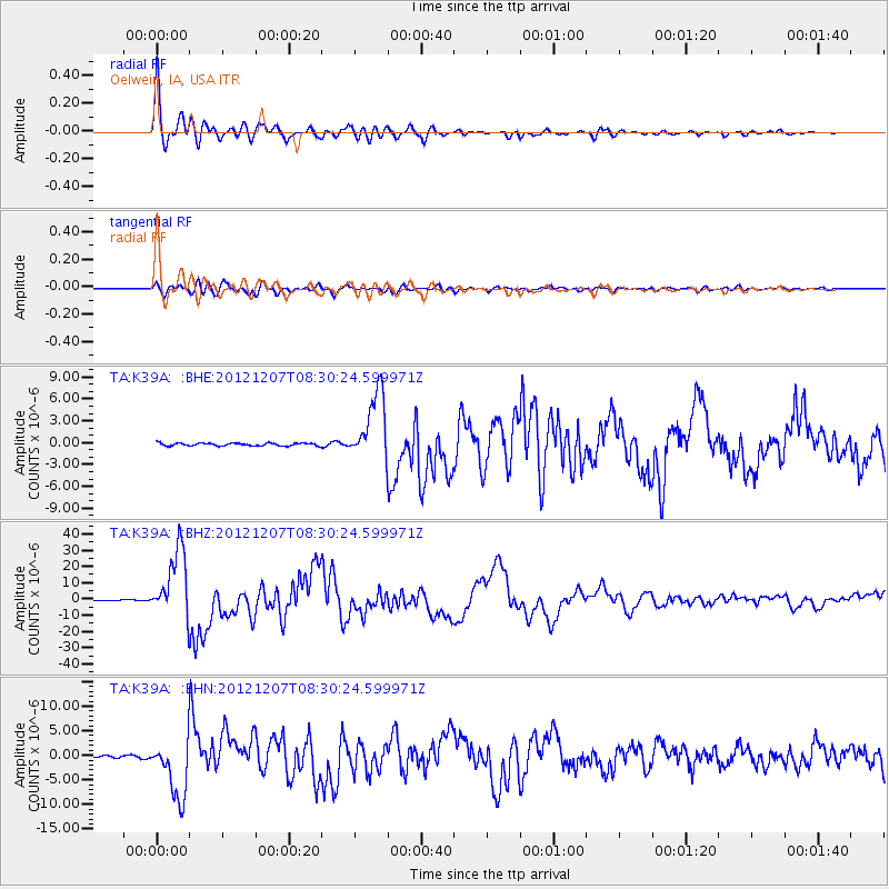
Signal To Noise
| Channel | StoN | STA | LTA |
| TA:K39A: :BHZ:20121207T08:30:24.599971Z | 142.23056 | 2.1077212E-5 | 1.4819048E-7 |
| TA:K39A: :BHN:20121207T08:30:24.599971Z | 27.001328 | 6.029695E-6 | 2.2331106E-7 |
| TA:K39A: :BHE:20121207T08:30:24.599971Z | 24.932873 | 4.7102935E-6 | 1.8891902E-7 |
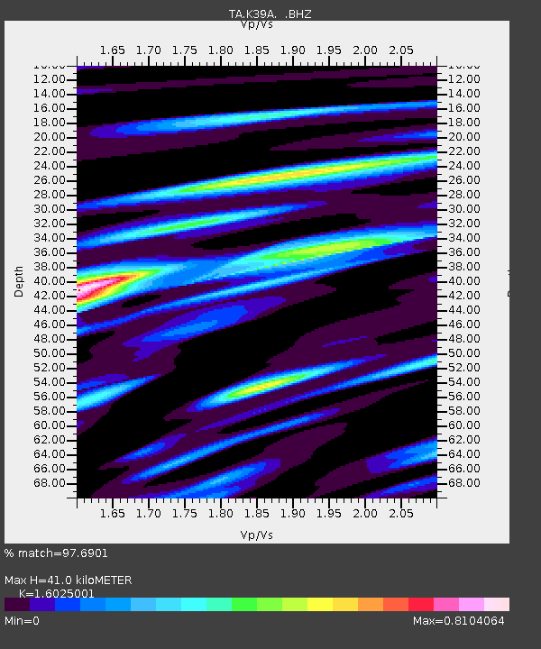
| Arrivals | |
| Ps | 3.9 SECOND |
| PpPs | 16 SECOND |
| PsPs/PpSs | 20 SECOND |

