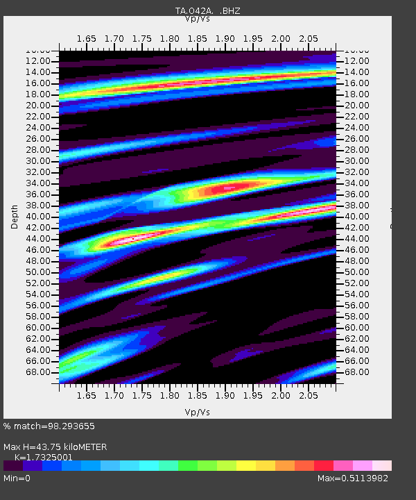
O42A Bath, IL, USA - Earthquake Result Viewer
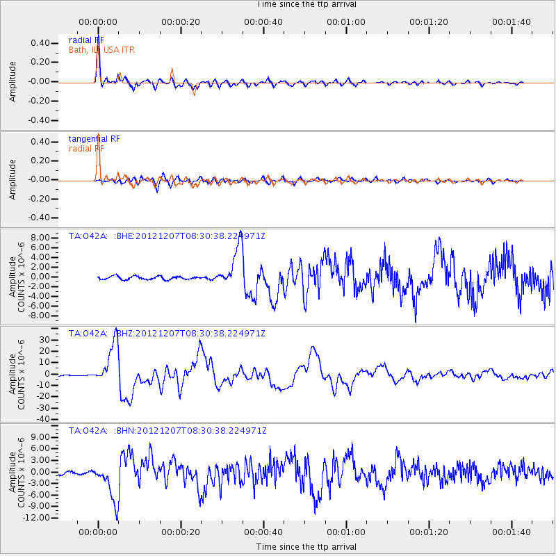
Earthquake location: Off East Coast Of Honshu, Japan
Earthquake latitude/longitude: 37.9/143.9
Earthquake time(UTC): 2012/12/07 (342) 08:18:23 GMT
Earthquake Depth: 31 km
Earthquake Magnitude: 7.2 MB, 7.3 MS, 7.3 MW, 7.3 MW
Earthquake Catalog/Contributor: WHDF/NEIC
Network: TA USArray Transportable Network (new EarthScope stations)
Station: O42A Bath, IL, USA
Lat/Lon: 40.20 N/90.08 W
Elevation: 155 m
Distance: 87.9 deg
Az: 38.342 deg
Baz: 320.151 deg
Ray Param: 0.042971652
Estimated Moho Depth: 43.75 km
Estimated Crust Vp/Vs: 1.73
Assumed Crust Vp: 6.498 km/s
Estimated Crust Vs: 3.75 km/s
Estimated Crust Poisson's Ratio: 0.25
Radial Match: 98.293655 %
Radial Bump: 400
Transverse Match: 85.84155 %
Transverse Bump: 400
SOD ConfigId: 488671
Insert Time: 2013-03-29 04:35:06.229 +0000
GWidth: 2.5
Max Bumps: 400
Tol: 0.001

Signal To Noise

ChannelStoNSTALTA
TA:O42A: :BHZ:20121207T08:30:38.224971Z41.152991.962146E-54.7679313E-7
TA:O42A: :BHN:20121207T08:30:38.224971Z16.748755.290146E-63.1585316E-7
TA:O42A: :BHE:20121207T08:30:38.224971Z13.7035864.391474E-63.2046165E-7
Arrivals
Ps5.0 SECOND
PpPs18 SECOND
PsPs/PpSs23 SECOND