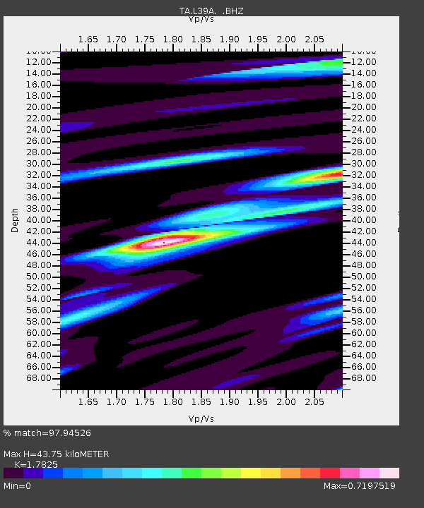
L39A Vinton, IA, USA - Earthquake Result Viewer
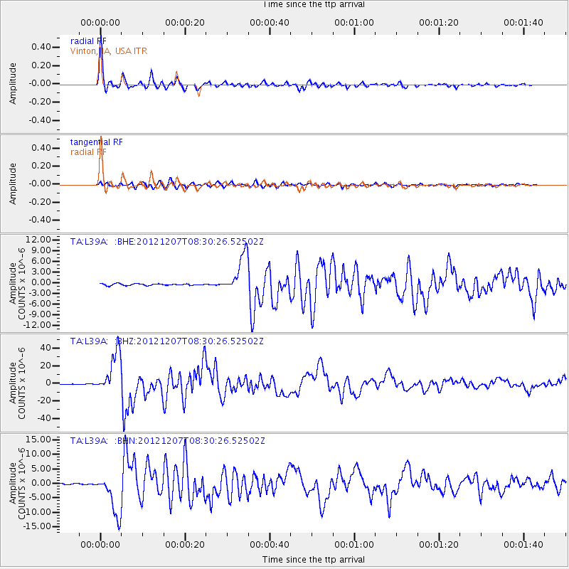
Earthquake location: Off East Coast Of Honshu, Japan
Earthquake latitude/longitude: 37.9/143.9
Earthquake time(UTC): 2012/12/07 (342) 08:18:23 GMT
Earthquake Depth: 31 km
Earthquake Magnitude: 7.2 MB, 7.3 MS, 7.3 MW, 7.3 MW
Earthquake Catalog/Contributor: WHDF/NEIC
Network: TA USArray Transportable Network (new EarthScope stations)
Station: L39A Vinton, IA, USA
Lat/Lon: 42.12 N/92.00 W
Elevation: 261 m
Distance: 85.5 deg
Az: 38.194 deg
Baz: 318.883 deg
Ray Param: 0.044707954
Estimated Moho Depth: 43.75 km
Estimated Crust Vp/Vs: 1.78
Assumed Crust Vp: 6.53 km/s
Estimated Crust Vs: 3.664 km/s
Estimated Crust Poisson's Ratio: 0.27
Radial Match: 97.94526 %
Radial Bump: 347
Transverse Match: 95.40265 %
Transverse Bump: 400
SOD ConfigId: 488671
Insert Time: 2013-03-29 04:35:13.289 +0000
GWidth: 2.5
Max Bumps: 400
Tol: 0.001

Signal To Noise

ChannelStoNSTALTA
TA:L39A: :BHZ:20121207T08:30:26.52502Z110.9406362.4624333E-52.2195952E-7
TA:L39A: :BHN:20121207T08:30:26.52502Z32.4758347.3749875E-62.2709155E-7
TA:L39A: :BHE:20121207T08:30:26.52502Z23.8749855.61652E-62.3524706E-7
Arrivals
Ps5.4 SECOND
PpPs18 SECOND
PsPs/PpSs24 SECOND