T44A Benton, MO, USA - Earthquake Result Viewer
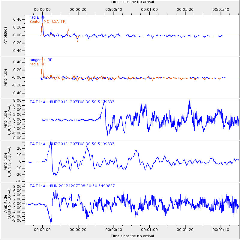
Earthquake location: Off East Coast Of Honshu, Japan
Earthquake latitude/longitude: 37.9/143.9
Earthquake time(UTC): 2012/12/07 (342) 08:18:23 GMT
Earthquake Depth: 31 km
Earthquake Magnitude: 7.2 MB, 7.3 MS, 7.3 MW, 7.3 MW
Earthquake Catalog/Contributor: WHDF/NEIC
Network: TA USArray Transportable Network (new EarthScope stations)
Station: T44A Benton, MO, USA
Lat/Lon: 37.09 N/89.59 W
Elevation: 133 m
Distance: 90.5 deg
Az: 40.028 deg
Baz: 320.48 deg
Ray Param: 0.04166511
Estimated Moho Depth: 53.25 km
Estimated Crust Vp/Vs: 1.60
Assumed Crust Vp: 6.444 km/s
Estimated Crust Vs: 4.027 km/s
Estimated Crust Poisson's Ratio: 0.18
Radial Match: 98.44841 %
Radial Bump: 253
Transverse Match: 92.1751 %
Transverse Bump: 400
SOD ConfigId: 488671
Insert Time: 2013-03-29 04:35:56.561 +0000
GWidth: 2.5
Max Bumps: 400
Tol: 0.001

Signal To Noise

ChannelStoNSTALTA
TA:T44A: :BHZ:20121207T08:30:50.549983Z58.7634771.3751536E-52.3401502E-7
TA:T44A: :BHN:20121207T08:30:50.549983Z17.9325623.573537E-61.9927643E-7
TA:T44A: :BHE:20121207T08:30:50.549983Z18.2546733.5180476E-61.9272039E-7
Arrivals
Ps5.1 SECOND
PpPs21 SECOND
PsPs/PpSs26 SECOND