S42A Caledonia, MO, USA - Earthquake Result Viewer
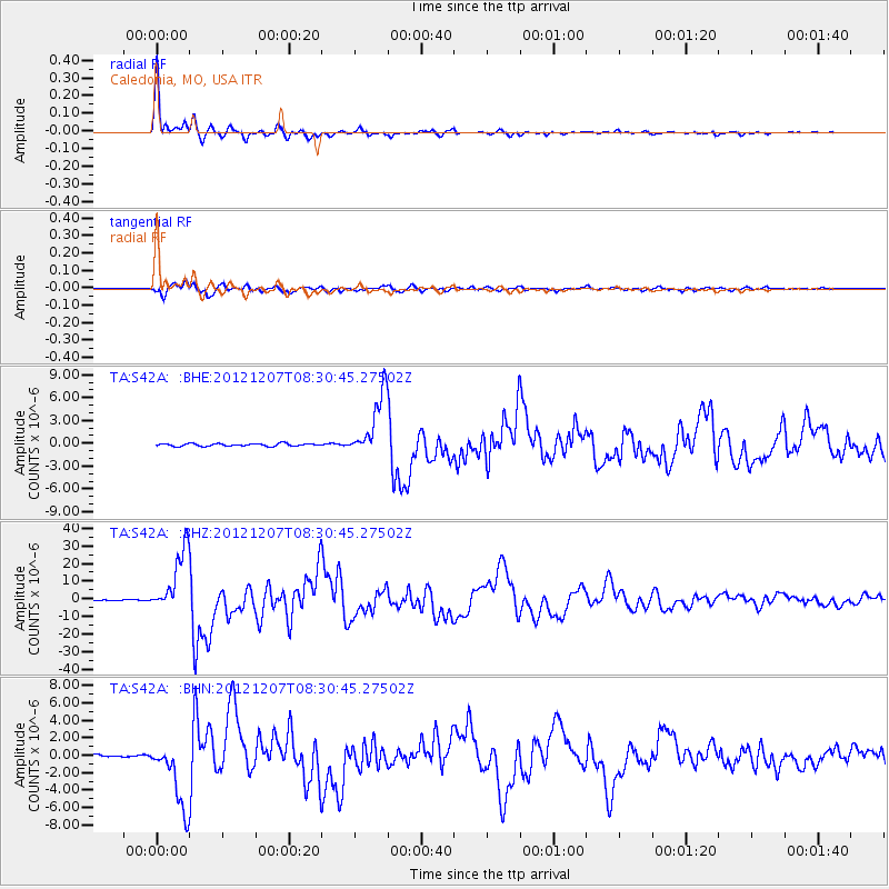
Earthquake location: Off East Coast Of Honshu, Japan
Earthquake latitude/longitude: 37.9/143.9
Earthquake time(UTC): 2012/12/07 (342) 08:18:23 GMT
Earthquake Depth: 31 km
Earthquake Magnitude: 7.2 MB, 7.3 MS, 7.3 MW, 7.3 MW
Earthquake Catalog/Contributor: WHDF/NEIC
Network: TA USArray Transportable Network (new EarthScope stations)
Station: S42A Caledonia, MO, USA
Lat/Lon: 37.77 N/90.79 W
Elevation: 315 m
Distance: 89.4 deg
Az: 40.326 deg
Baz: 319.752 deg
Ray Param: 0.04186655
Estimated Moho Depth: 14.5 km
Estimated Crust Vp/Vs: 1.63
Assumed Crust Vp: 6.53 km/s
Estimated Crust Vs: 4.006 km/s
Estimated Crust Poisson's Ratio: 0.20
Radial Match: 98.96826 %
Radial Bump: 283
Transverse Match: 96.124146 %
Transverse Bump: 400
SOD ConfigId: 488671
Insert Time: 2013-03-29 04:36:06.664 +0000
GWidth: 2.5
Max Bumps: 400
Tol: 0.001

Signal To Noise

ChannelStoNSTALTA
TA:S42A: :BHZ:20121207T08:30:45.27502Z89.726091.7879727E-51.992701E-7
TA:S42A: :BHN:20121207T08:30:45.27502Z20.3724963.851541E-61.8905591E-7
TA:S42A: :BHE:20121207T08:30:45.27502Z24.214854.1382605E-61.7089764E-7
Arrivals
Ps1.4 SECOND
PpPs5.7 SECOND
PsPs/PpSs7.1 SECOND