R41A Rosebud, MO, USA - Earthquake Result Viewer
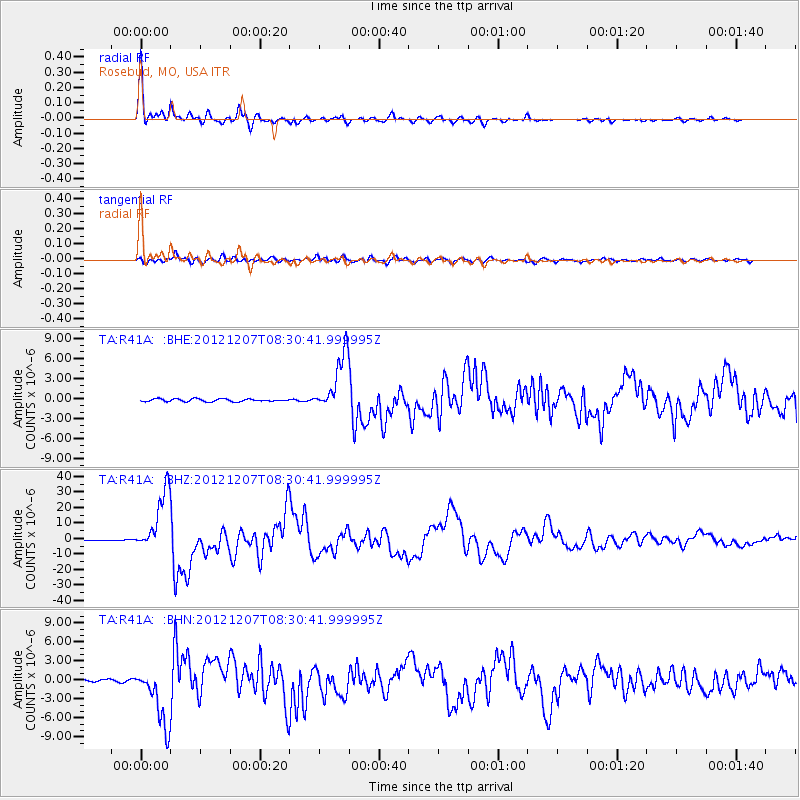
Earthquake location: Off East Coast Of Honshu, Japan
Earthquake latitude/longitude: 37.9/143.9
Earthquake time(UTC): 2012/12/07 (342) 08:18:23 GMT
Earthquake Depth: 31 km
Earthquake Magnitude: 7.2 MB, 7.3 MS, 7.3 MW, 7.3 MW
Earthquake Catalog/Contributor: WHDF/NEIC
Network: TA USArray Transportable Network (new EarthScope stations)
Station: R41A Rosebud, MO, USA
Lat/Lon: 38.30 N/91.38 W
Elevation: 257 m
Distance: 88.7 deg
Az: 40.337 deg
Baz: 319.393 deg
Ray Param: 0.04237987
Estimated Moho Depth: 38.75 km
Estimated Crust Vp/Vs: 1.82
Assumed Crust Vp: 6.498 km/s
Estimated Crust Vs: 3.58 km/s
Estimated Crust Poisson's Ratio: 0.28
Radial Match: 98.61354 %
Radial Bump: 361
Transverse Match: 91.657234 %
Transverse Bump: 400
SOD ConfigId: 488671
Insert Time: 2013-03-29 04:36:25.639 +0000
GWidth: 2.5
Max Bumps: 400
Tol: 0.001

Signal To Noise

ChannelStoNSTALTA
TA:R41A: :BHZ:20121207T08:30:41.999995Z93.4776151.9733807E-52.1110728E-7
TA:R41A: :BHN:20121207T08:30:41.999995Z23.9288564.6874993E-61.9589316E-7
TA:R41A: :BHE:20121207T08:30:41.999995Z22.1818454.296302E-61.9368551E-7
Arrivals
Ps5.0 SECOND
PpPs16 SECOND
PsPs/PpSs21 SECOND