M42A Sheffield, IL, USA - Earthquake Result Viewer
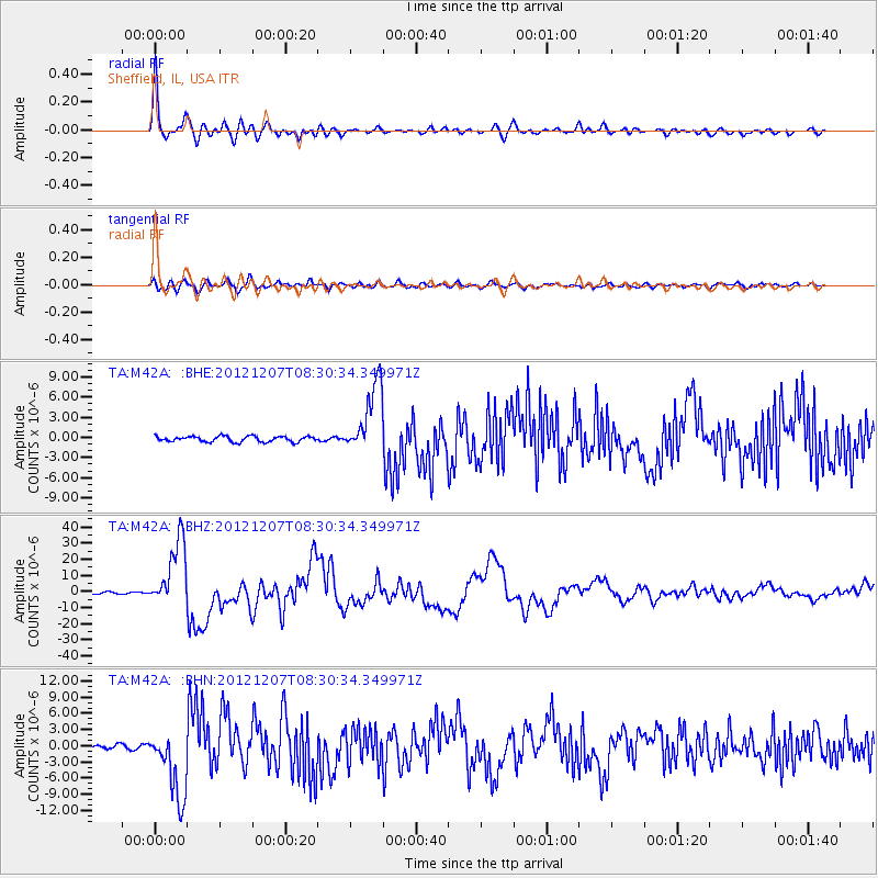
Earthquake location: Off East Coast Of Honshu, Japan
Earthquake latitude/longitude: 37.9/143.9
Earthquake time(UTC): 2012/12/07 (342) 08:18:23 GMT
Earthquake Depth: 31 km
Earthquake Magnitude: 7.2 MB, 7.3 MS, 7.3 MW, 7.3 MW
Earthquake Catalog/Contributor: WHDF/NEIC
Network: TA USArray Transportable Network (new EarthScope stations)
Station: M42A Sheffield, IL, USA
Lat/Lon: 41.45 N/89.76 W
Elevation: 212 m
Distance: 87.1 deg
Az: 37.348 deg
Baz: 320.317 deg
Ray Param: 0.04356006
Estimated Moho Depth: 42.25 km
Estimated Crust Vp/Vs: 1.73
Assumed Crust Vp: 6.498 km/s
Estimated Crust Vs: 3.761 km/s
Estimated Crust Poisson's Ratio: 0.25
Radial Match: 96.62786 %
Radial Bump: 400
Transverse Match: 84.42789 %
Transverse Bump: 400
SOD ConfigId: 488671
Insert Time: 2013-03-29 04:36:37.534 +0000
GWidth: 2.5
Max Bumps: 400
Tol: 0.001

Signal To Noise

ChannelStoNSTALTA
TA:M42A: :BHZ:20121207T08:30:34.349971Z50.25912.098249E-54.1748638E-7
TA:M42A: :BHN:20121207T08:30:34.349971Z21.4003856.5020536E-63.038288E-7
TA:M42A: :BHE:20121207T08:30:34.349971Z12.7723795.234144E-64.098018E-7
Arrivals
Ps4.8 SECOND
PpPs17 SECOND
PsPs/PpSs22 SECOND