I39A Houston, MN, USA - Earthquake Result Viewer
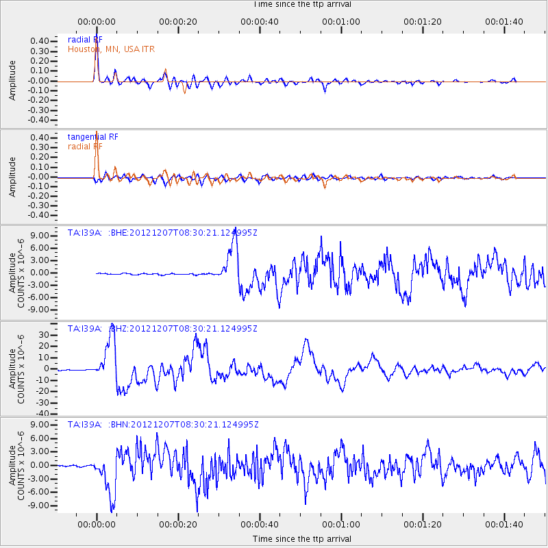
Earthquake location: Off East Coast Of Honshu, Japan
Earthquake latitude/longitude: 37.9/143.9
Earthquake time(UTC): 2012/12/07 (342) 08:18:23 GMT
Earthquake Depth: 31 km
Earthquake Magnitude: 7.2 MB, 7.3 MS, 7.3 MW, 7.3 MW
Earthquake Catalog/Contributor: WHDF/NEIC
Network: TA USArray Transportable Network (new EarthScope stations)
Station: I39A Houston, MN, USA
Lat/Lon: 43.85 N/91.52 W
Elevation: 393 m
Distance: 84.4 deg
Az: 36.789 deg
Baz: 319.083 deg
Ray Param: 0.045480173
Estimated Moho Depth: 37.5 km
Estimated Crust Vp/Vs: 1.76
Assumed Crust Vp: 6.53 km/s
Estimated Crust Vs: 3.71 km/s
Estimated Crust Poisson's Ratio: 0.26
Radial Match: 96.82631 %
Radial Bump: 400
Transverse Match: 91.266106 %
Transverse Bump: 400
SOD ConfigId: 488671
Insert Time: 2013-03-29 04:37:30.873 +0000
GWidth: 2.5
Max Bumps: 400
Tol: 0.001

Signal To Noise

ChannelStoNSTALTA
TA:I39A: :BHZ:20121207T08:30:21.124995Z105.820072.0419346E-51.9296289E-7
TA:I39A: :BHN:20121207T08:30:21.124995Z23.528934.823335E-62.0499593E-7
TA:I39A: :BHE:20121207T08:30:21.124995Z35.884965.255419E-61.4645185E-7
Arrivals
Ps4.5 SECOND
PpPs15 SECOND
PsPs/PpSs20 SECOND