H38A Maiden Rock, WI, USA - Earthquake Result Viewer
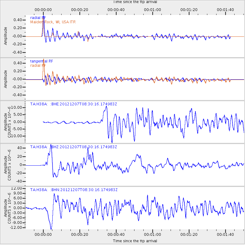
Earthquake location: Off East Coast Of Honshu, Japan
Earthquake latitude/longitude: 37.9/143.9
Earthquake time(UTC): 2012/12/07 (342) 08:18:23 GMT
Earthquake Depth: 31 km
Earthquake Magnitude: 7.2 MB, 7.3 MS, 7.3 MW, 7.3 MW
Earthquake Catalog/Contributor: WHDF/NEIC
Network: TA USArray Transportable Network (new EarthScope stations)
Station: H38A Maiden Rock, WI, USA
Lat/Lon: 44.68 N/92.28 W
Elevation: 333 m
Distance: 83.4 deg
Az: 36.658 deg
Baz: 318.542 deg
Ray Param: 0.0461682
Estimated Moho Depth: 49.5 km
Estimated Crust Vp/Vs: 1.68
Assumed Crust Vp: 6.571 km/s
Estimated Crust Vs: 3.905 km/s
Estimated Crust Poisson's Ratio: 0.23
Radial Match: 97.09598 %
Radial Bump: 400
Transverse Match: 91.61353 %
Transverse Bump: 400
SOD ConfigId: 488671
Insert Time: 2013-03-29 04:37:42.065 +0000
GWidth: 2.5
Max Bumps: 400
Tol: 0.001

Signal To Noise

ChannelStoNSTALTA
TA:H38A: :BHZ:20121207T08:30:16.174983Z80.853762.2386515E-52.7687662E-7
TA:H38A: :BHN:20121207T08:30:16.174983Z21.0044235.9637377E-62.8392773E-7
TA:H38A: :BHE:20121207T08:30:16.174983Z13.1726575.36232E-64.070796E-7
Arrivals
Ps5.3 SECOND
PpPs20 SECOND
PsPs/PpSs25 SECOND