G40A Rib Lake, WI, USA - Earthquake Result Viewer
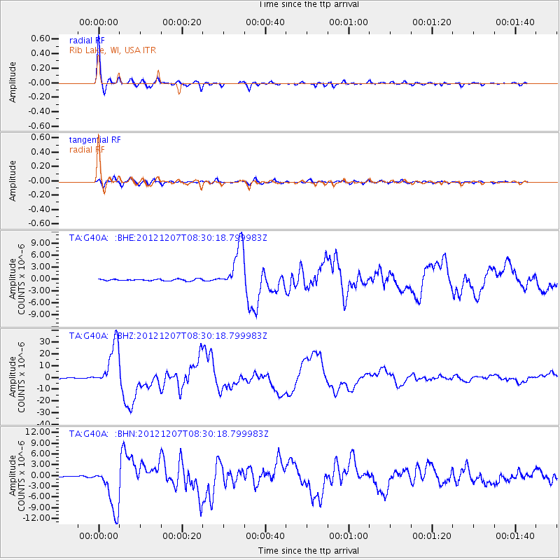
Earthquake location: Off East Coast Of Honshu, Japan
Earthquake latitude/longitude: 37.9/143.9
Earthquake time(UTC): 2012/12/07 (342) 08:18:23 GMT
Earthquake Depth: 31 km
Earthquake Magnitude: 7.2 MB, 7.3 MS, 7.3 MW, 7.3 MW
Earthquake Catalog/Contributor: WHDF/NEIC
Network: TA USArray Transportable Network (new EarthScope stations)
Station: G40A Rib Lake, WI, USA
Lat/Lon: 45.27 N/90.20 W
Elevation: 472 m
Distance: 83.9 deg
Az: 35.143 deg
Baz: 319.841 deg
Ray Param: 0.04580018
Estimated Moho Depth: 50.75 km
Estimated Crust Vp/Vs: 1.63
Assumed Crust Vp: 6.571 km/s
Estimated Crust Vs: 4.019 km/s
Estimated Crust Poisson's Ratio: 0.20
Radial Match: 98.97857 %
Radial Bump: 356
Transverse Match: 91.19579 %
Transverse Bump: 400
SOD ConfigId: 488671
Insert Time: 2013-03-29 04:38:20.156 +0000
GWidth: 2.5
Max Bumps: 400
Tol: 0.001

Signal To Noise

ChannelStoNSTALTA
TA:G40A: :BHZ:20121207T08:30:18.799983Z70.525151.9500023E-52.7649745E-7
TA:G40A: :BHN:20121207T08:30:18.799983Z25.9144296.6981365E-62.5847132E-7
TA:G40A: :BHE:20121207T08:30:18.799983Z28.2226165.7522675E-62.0381765E-7
Arrivals
Ps5.0 SECOND
PpPs20 SECOND
PsPs/PpSs25 SECOND