
D41A Chassel, MI, USA - Earthquake Result Viewer
| ||||||||||||||||||
| ||||||||||||||||||
| ||||||||||||||||||
|
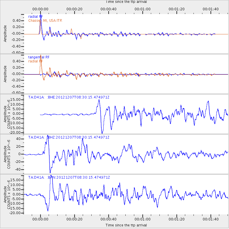
Signal To Noise
| Channel | StoN | STA | LTA |
| TA:D41A: :BHZ:20121207T08:30:15.474971Z | 48.043026 | 2.3392528E-5 | 4.869079E-7 |
| TA:D41A: :BHN:20121207T08:30:15.474971Z | 11.549706 | 7.602125E-6 | 6.582094E-7 |
| TA:D41A: :BHE:20121207T08:30:15.474971Z | 17.51923 | 6.6929456E-6 | 3.8203424E-7 |
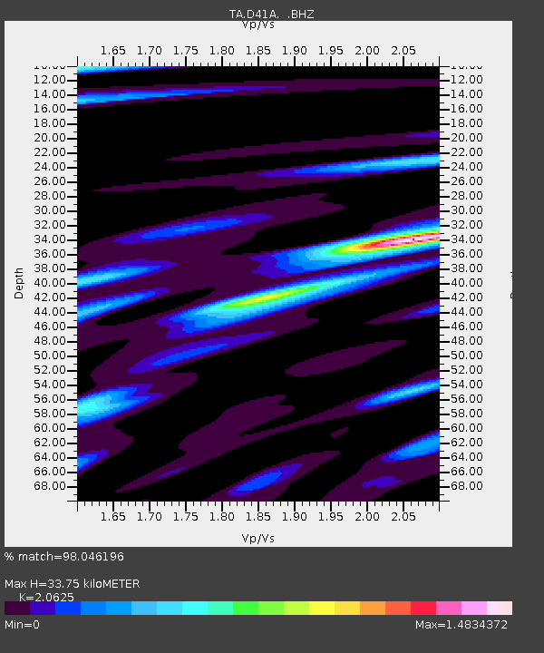
| Arrivals | |
| Ps | 5.7 SECOND |
| PpPs | 16 SECOND |
| PsPs/PpSs | 21 SECOND |

