Y48A Jasper, AL, USA - Earthquake Result Viewer
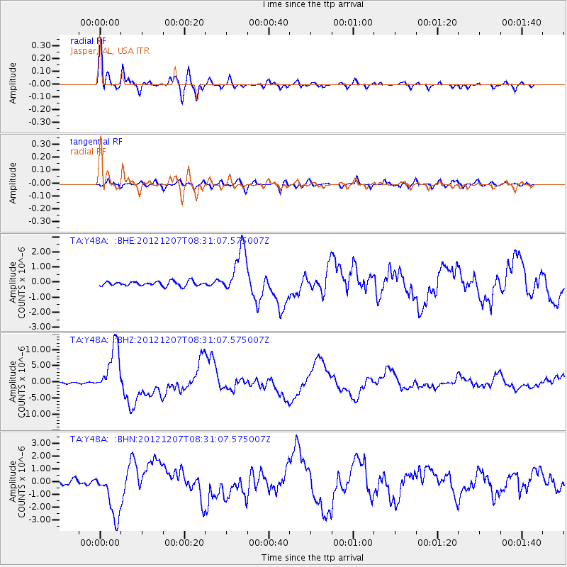
Earthquake location: Off East Coast Of Honshu, Japan
Earthquake latitude/longitude: 37.9/143.9
Earthquake time(UTC): 2012/12/07 (342) 08:18:23 GMT
Earthquake Depth: 31 km
Earthquake Magnitude: 7.2 MB, 7.3 MS, 7.3 MW, 7.3 MW
Earthquake Catalog/Contributor: WHDF/NEIC
Network: TA USArray Transportable Network (new EarthScope stations)
Station: Y48A Jasper, AL, USA
Lat/Lon: 33.91 N/87.17 W
Elevation: 170 m
Distance: 94.2 deg
Az: 40.475 deg
Baz: 321.862 deg
Ray Param: 0.04108583
Estimated Moho Depth: 41.25 km
Estimated Crust Vp/Vs: 1.85
Assumed Crust Vp: 6.565 km/s
Estimated Crust Vs: 3.548 km/s
Estimated Crust Poisson's Ratio: 0.29
Radial Match: 95.526985 %
Radial Bump: 382
Transverse Match: 83.54152 %
Transverse Bump: 400
SOD ConfigId: 488671
Insert Time: 2013-03-29 04:44:03.161 +0000
GWidth: 2.5
Max Bumps: 400
Tol: 0.001

Signal To Noise

ChannelStoNSTALTA
TA:Y48A: :BHZ:20121207T08:31:07.575007Z33.5963067.586149E-62.2580308E-7
TA:Y48A: :BHN:20121207T08:31:07.575007Z8.6040311.9110003E-62.2210523E-7
TA:Y48A: :BHE:20121207T08:31:07.575007Z10.5319161.5797754E-61.4999887E-7
Arrivals
Ps5.4 SECOND
PpPs18 SECOND
PsPs/PpSs23 SECOND