Y49A New Hope, AL, USA - Earthquake Result Viewer
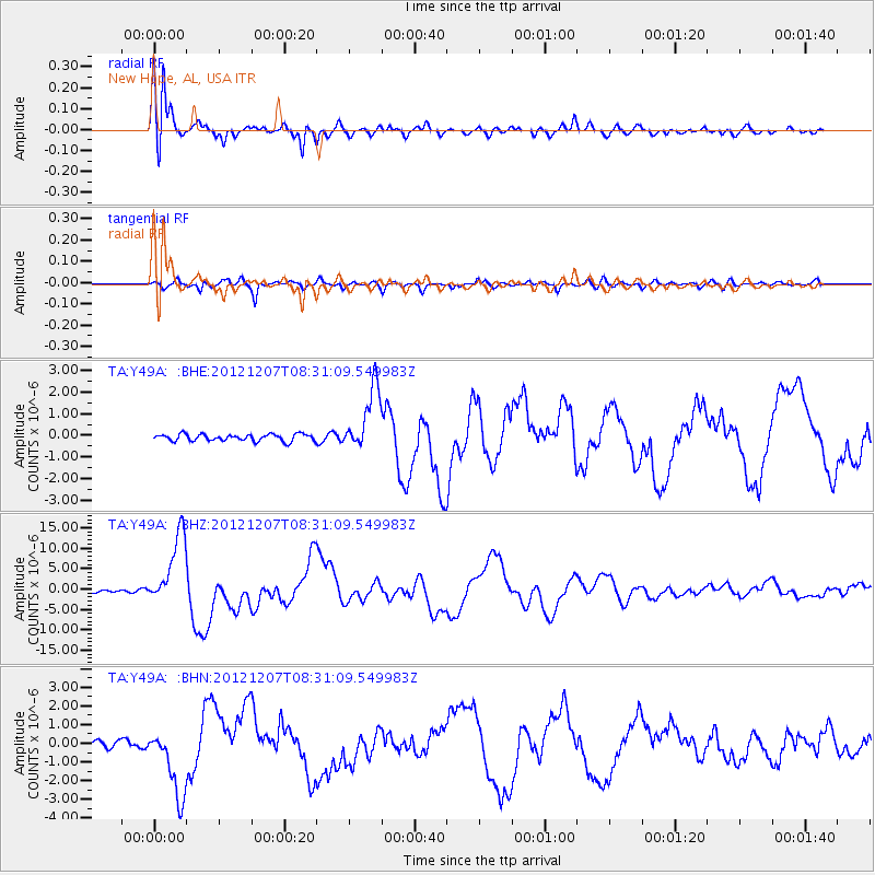
Earthquake location: Off East Coast Of Honshu, Japan
Earthquake latitude/longitude: 37.9/143.9
Earthquake time(UTC): 2012/12/07 (342) 08:18:23 GMT
Earthquake Depth: 31 km
Earthquake Magnitude: 7.2 MB, 7.3 MS, 7.3 MW, 7.3 MW
Earthquake Catalog/Contributor: WHDF/NEIC
Network: TA USArray Transportable Network (new EarthScope stations)
Station: Y49A New Hope, AL, USA
Lat/Lon: 33.86 N/86.41 W
Elevation: 362 m
Distance: 94.6 deg
Az: 40.01 deg
Baz: 322.318 deg
Ray Param: 0.040981535
Estimated Moho Depth: 18.5 km
Estimated Crust Vp/Vs: 1.95
Assumed Crust Vp: 6.565 km/s
Estimated Crust Vs: 3.371 km/s
Estimated Crust Poisson's Ratio: 0.32
Radial Match: 96.54748 %
Radial Bump: 378
Transverse Match: 85.90706 %
Transverse Bump: 400
SOD ConfigId: 488671
Insert Time: 2013-03-29 04:44:11.186 +0000
GWidth: 2.5
Max Bumps: 400
Tol: 0.001

Signal To Noise

ChannelStoNSTALTA
TA:Y49A: :BHZ:20121207T08:31:09.549983Z26.751238.883069E-63.320621E-7
TA:Y49A: :BHN:20121207T08:31:09.549983Z10.2290621.8512948E-61.8098382E-7
TA:Y49A: :BHE:20121207T08:31:09.549983Z9.3551521.4826818E-61.5848826E-7
Arrivals
Ps2.7 SECOND
PpPs8.2 SECOND
PsPs/PpSs11 SECOND