250A Grady, AL, USA - Earthquake Result Viewer
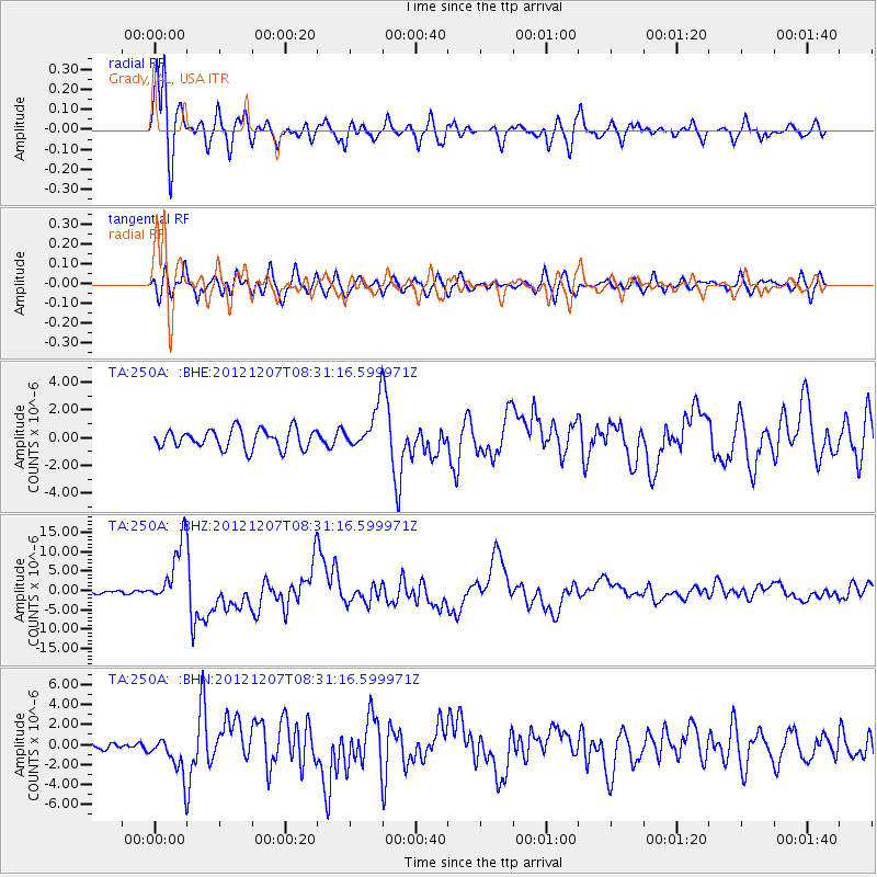
Earthquake location: Off East Coast Of Honshu, Japan
Earthquake latitude/longitude: 37.9/143.9
Earthquake time(UTC): 2012/12/07 (342) 08:18:23 GMT
Earthquake Depth: 31 km
Earthquake Magnitude: 7.2 MB, 7.3 MS, 7.3 MW, 7.3 MW
Earthquake Catalog/Contributor: WHDF/NEIC
Network: TA USArray Transportable Network (new EarthScope stations)
Station: 250A Grady, AL, USA
Lat/Lon: 31.98 N/86.27 W
Elevation: 152 m
Distance: 96.2 deg
Az: 41.065 deg
Baz: 322.297 deg
Ray Param: 0.040568013
Estimated Moho Depth: 16.5 km
Estimated Crust Vp/Vs: 1.60
Assumed Crust Vp: 6.187 km/s
Estimated Crust Vs: 3.867 km/s
Estimated Crust Poisson's Ratio: 0.18
Radial Match: 92.71898 %
Radial Bump: 400
Transverse Match: 81.02629 %
Transverse Bump: 400
SOD ConfigId: 488671
Insert Time: 2013-03-29 04:45:34.679 +0000
GWidth: 2.5
Max Bumps: 400
Tol: 0.001

Signal To Noise

ChannelStoNSTALTA
TA:250A: :BHZ:20121207T08:31:16.599971Z34.229338.213694E-62.399607E-7
TA:250A: :BHN:20121207T08:31:16.599971Z4.8160431.942284E-64.0329456E-7
TA:250A: :BHE:20121207T08:31:16.599971Z2.23727561.5656409E-66.9979797E-7
Arrivals
Ps1.6 SECOND
PpPs6.8 SECOND
PsPs/PpSs8.4 SECOND