251A Midway, AL, USA - Earthquake Result Viewer
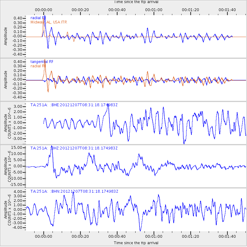
Earthquake location: Off East Coast Of Honshu, Japan
Earthquake latitude/longitude: 37.9/143.9
Earthquake time(UTC): 2012/12/07 (342) 08:18:23 GMT
Earthquake Depth: 31 km
Earthquake Magnitude: 7.2 MB, 7.3 MS, 7.3 MW, 7.3 MW
Earthquake Catalog/Contributor: WHDF/NEIC
Network: TA USArray Transportable Network (new EarthScope stations)
Station: 251A Midway, AL, USA
Lat/Lon: 32.09 N/85.41 W
Elevation: 139 m
Distance: 96.5 deg
Az: 40.412 deg
Baz: 322.822 deg
Ray Param: 0.04046783
Estimated Moho Depth: 48.0 km
Estimated Crust Vp/Vs: 1.60
Assumed Crust Vp: 6.719 km/s
Estimated Crust Vs: 4.2 km/s
Estimated Crust Poisson's Ratio: 0.18
Radial Match: 91.41994 %
Radial Bump: 400
Transverse Match: 74.02014 %
Transverse Bump: 400
SOD ConfigId: 488671
Insert Time: 2013-03-29 04:45:46.492 +0000
GWidth: 2.5
Max Bumps: 400
Tol: 0.001

Signal To Noise

ChannelStoNSTALTA
TA:251A: :BHZ:20121207T08:31:18.174983Z35.933827.3937135E-62.0575919E-7
TA:251A: :BHN:20121207T08:31:18.174983Z3.12221051.6529183E-65.294064E-7
TA:251A: :BHE:20121207T08:31:18.174983Z2.71536141.5279275E-65.626976E-7
Arrivals
Ps4.4 SECOND
PpPs18 SECOND
PsPs/PpSs23 SECOND