353A Camilla, GA, USA - Earthquake Result Viewer
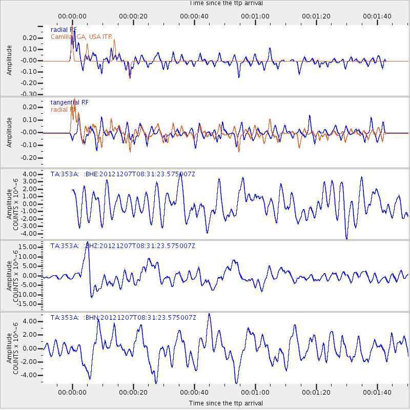
Earthquake location: Off East Coast Of Honshu, Japan
Earthquake latitude/longitude: 37.9/143.9
Earthquake time(UTC): 2012/12/07 (342) 08:18:23 GMT
Earthquake Depth: 31 km
Earthquake Magnitude: 7.2 MB, 7.3 MS, 7.3 MW, 7.3 MW
Earthquake Catalog/Contributor: WHDF/NEIC
Network: TA USArray Transportable Network (new EarthScope stations)
Station: 353A Camilla, GA, USA
Lat/Lon: 31.35 N/84.22 W
Elevation: 54 m
Distance: 97.8 deg
Az: 40.042 deg
Baz: 323.492 deg
Ray Param: 0.04010425
Estimated Moho Depth: 18.0 km
Estimated Crust Vp/Vs: 1.75
Assumed Crust Vp: 6.347 km/s
Estimated Crust Vs: 3.627 km/s
Estimated Crust Poisson's Ratio: 0.26
Radial Match: 88.83566 %
Radial Bump: 400
Transverse Match: 63.748367 %
Transverse Bump: 400
SOD ConfigId: 488671
Insert Time: 2013-03-29 04:46:11.250 +0000
GWidth: 2.5
Max Bumps: 400
Tol: 0.001

Signal To Noise

ChannelStoNSTALTA
TA:353A: :BHZ:20121207T08:31:23.575007Z12.2381076.72059E-65.4915273E-7
TA:353A: :BHN:20121207T08:31:23.575007Z2.24853921.4974972E-66.6598676E-7
TA:353A: :BHE:20121207T08:31:23.575007Z1.05053951.5322809E-61.4585657E-6
Arrivals
Ps2.2 SECOND
PpPs7.7 SECOND
PsPs/PpSs9.8 SECOND