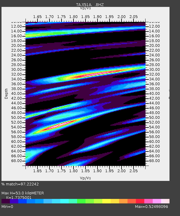
X51A Calhoun, GA, USA - Earthquake Result Viewer
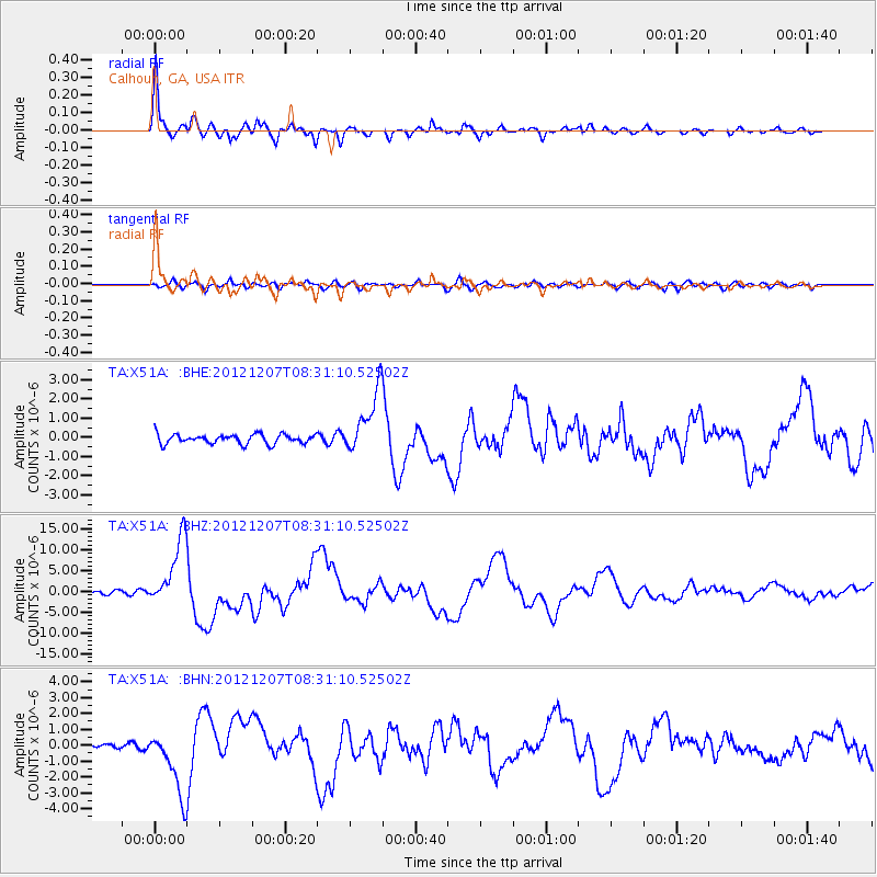
Earthquake location: Off East Coast Of Honshu, Japan
Earthquake latitude/longitude: 37.9/143.9
Earthquake time(UTC): 2012/12/07 (342) 08:18:23 GMT
Earthquake Depth: 31 km
Earthquake Magnitude: 7.2 MB, 7.3 MS, 7.3 MW, 7.3 MW
Earthquake Catalog/Contributor: WHDF/NEIC
Network: TA USArray Transportable Network (new EarthScope stations)
Station: X51A Calhoun, GA, USA
Lat/Lon: 34.57 N/84.86 W
Elevation: 214 m
Distance: 94.9 deg
Az: 38.552 deg
Baz: 323.309 deg
Ray Param: 0.040924206
Estimated Moho Depth: 53.0 km
Estimated Crust Vp/Vs: 1.74
Assumed Crust Vp: 6.35 km/s
Estimated Crust Vs: 3.655 km/s
Estimated Crust Poisson's Ratio: 0.25
Radial Match: 97.22242 %
Radial Bump: 376
Transverse Match: 78.67968 %
Transverse Bump: 400
SOD ConfigId: 488671
Insert Time: 2013-03-29 04:47:07.091 +0000
GWidth: 2.5
Max Bumps: 400
Tol: 0.001

Signal To Noise

ChannelStoNSTALTA
TA:X51A: :BHZ:20121207T08:31:10.52502Z25.3329898.174382E-63.2267735E-7
TA:X51A: :BHN:20121207T08:31:10.52502Z7.43586162.0604837E-62.771009E-7
TA:X51A: :BHE:20121207T08:31:10.52502Z6.58856631.632264E-62.4774192E-7
Arrivals
Ps6.3 SECOND
PpPs22 SECOND
PsPs/PpSs29 SECOND