
Y52A Lilburn, GA, USA - Earthquake Result Viewer
| ||||||||||||||||||
| ||||||||||||||||||
| ||||||||||||||||||
|
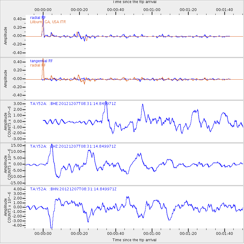
Signal To Noise
| Channel | StoN | STA | LTA |
| TA:Y52A: :BHZ:20121207T08:31:14.849971Z | 16.414703 | 6.7731E-6 | 4.1262393E-7 |
| TA:Y52A: :BHN:20121207T08:31:14.849971Z | 7.140583 | 1.9152242E-6 | 2.6821678E-7 |
| TA:Y52A: :BHE:20121207T08:31:14.849971Z | 7.271153 | 1.4830599E-6 | 2.0396489E-7 |
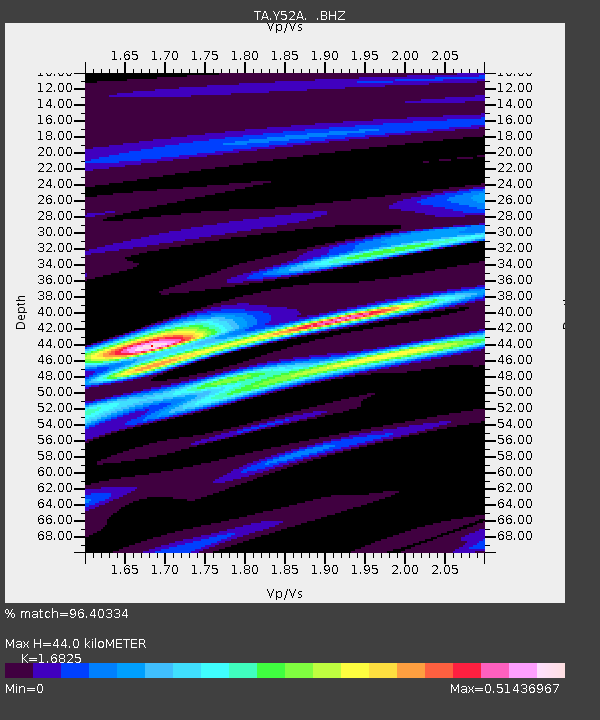
| Arrivals | |
| Ps | 4.6 SECOND |
| PpPs | 17 SECOND |
| PsPs/PpSs | 22 SECOND |

