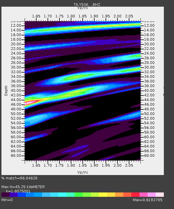
Y53A Monroe, GA, USA - Earthquake Result Viewer
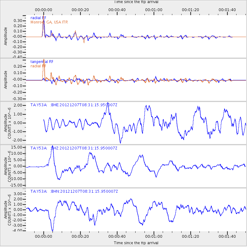
Earthquake location: Off East Coast Of Honshu, Japan
Earthquake latitude/longitude: 37.9/143.9
Earthquake time(UTC): 2012/12/07 (342) 08:18:23 GMT
Earthquake Depth: 31 km
Earthquake Magnitude: 7.2 MB, 7.3 MS, 7.3 MW, 7.3 MW
Earthquake Catalog/Contributor: WHDF/NEIC
Network: TA USArray Transportable Network (new EarthScope stations)
Station: Y53A Monroe, GA, USA
Lat/Lon: 33.86 N/83.58 W
Elevation: 234 m
Distance: 96.1 deg
Az: 38.119 deg
Baz: 324.063 deg
Ray Param: 0.04060666
Estimated Moho Depth: 45.25 km
Estimated Crust Vp/Vs: 1.61
Assumed Crust Vp: 6.565 km/s
Estimated Crust Vs: 4.084 km/s
Estimated Crust Poisson's Ratio: 0.18
Radial Match: 96.84628 %
Radial Bump: 400
Transverse Match: 63.16709 %
Transverse Bump: 400
SOD ConfigId: 488671
Insert Time: 2013-03-29 04:48:04.322 +0000
GWidth: 2.5
Max Bumps: 400
Tol: 0.001

Signal To Noise

ChannelStoNSTALTA
TA:Y53A: :BHZ:20121207T08:31:15.950007Z18.6183346.52294E-63.5035038E-7
TA:Y53A: :BHN:20121207T08:31:15.950007Z7.4564941.5591387E-62.090981E-7
TA:Y53A: :BHE:20121207T08:31:15.950007Z2.57932269.835084E-73.8130491E-7
Arrivals
Ps4.3 SECOND
PpPs18 SECOND
PsPs/PpSs22 SECOND