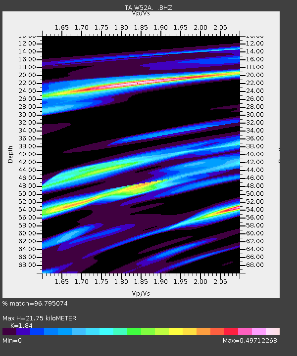
W52A Murphy, NC, USA - Earthquake Result Viewer
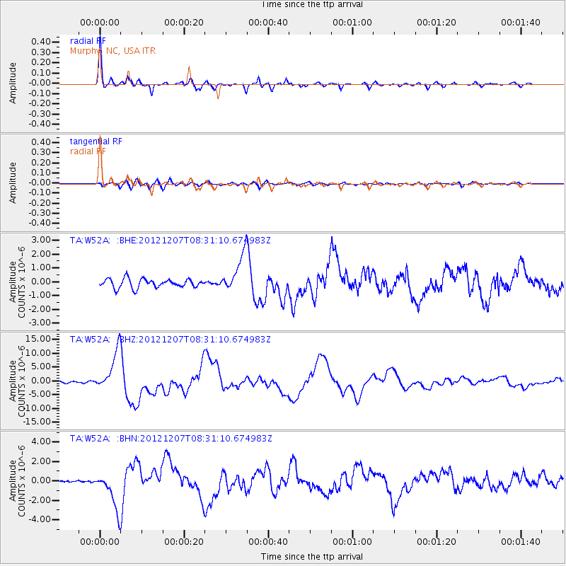
Earthquake location: Off East Coast Of Honshu, Japan
Earthquake latitude/longitude: 37.9/143.9
Earthquake time(UTC): 2012/12/07 (342) 08:18:23 GMT
Earthquake Depth: 31 km
Earthquake Magnitude: 7.2 MB, 7.3 MS, 7.3 MW, 7.3 MW
Earthquake Catalog/Contributor: WHDF/NEIC
Network: TA USArray Transportable Network (new EarthScope stations)
Station: W52A Murphy, NC, USA
Lat/Lon: 35.09 N/83.93 W
Elevation: 519 m
Distance: 94.9 deg
Az: 37.621 deg
Baz: 323.917 deg
Ray Param: 0.04091626
Estimated Moho Depth: 21.75 km
Estimated Crust Vp/Vs: 1.84
Assumed Crust Vp: 6.35 km/s
Estimated Crust Vs: 3.451 km/s
Estimated Crust Poisson's Ratio: 0.29
Radial Match: 96.795074 %
Radial Bump: 365
Transverse Match: 76.00267 %
Transverse Bump: 400
SOD ConfigId: 488671
Insert Time: 2013-03-29 04:48:15.577 +0000
GWidth: 2.5
Max Bumps: 400
Tol: 0.001

Signal To Noise

ChannelStoNSTALTA
TA:W52A: :BHZ:20121207T08:31:10.674983Z24.8008167.453171E-63.005212E-7
TA:W52A: :BHN:20121207T08:31:10.674983Z11.5367362.0001446E-61.733718E-7
TA:W52A: :BHE:20121207T08:31:10.674983Z4.45838551.4256078E-63.1975875E-7
Arrivals
Ps2.9 SECOND
PpPs9.5 SECOND
PsPs/PpSs12 SECOND