
V49A McMinnville, TN, USA - Earthquake Result Viewer
| ||||||||||||||||||
| ||||||||||||||||||
| ||||||||||||||||||
|
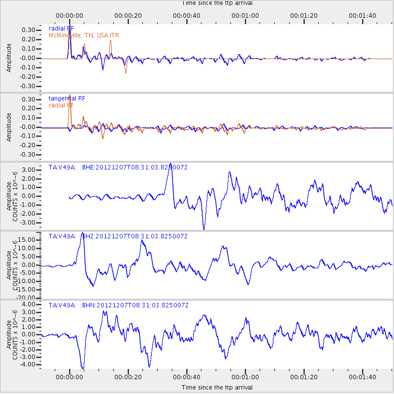
Signal To Noise
| Channel | StoN | STA | LTA |
| TA:V49A: :BHZ:20121207T08:31:03.825007Z | 30.19372 | 9.639697E-6 | 3.1926166E-7 |
| TA:V49A: :BHN:20121207T08:31:03.825007Z | 16.03535 | 2.0911896E-6 | 1.3041121E-7 |
| TA:V49A: :BHE:20121207T08:31:03.825007Z | 11.185885 | 1.7729828E-6 | 1.5850179E-7 |
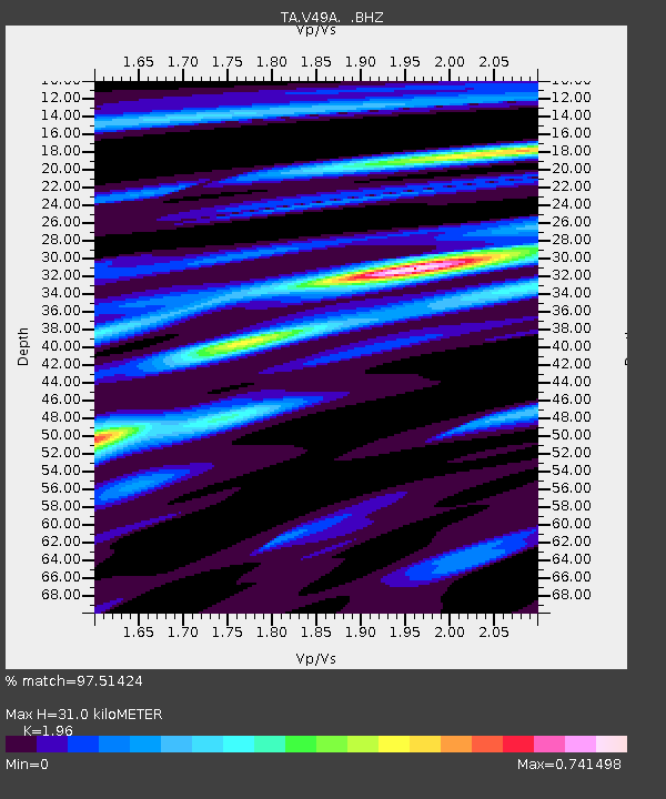
| Arrivals | |
| Ps | 4.8 SECOND |
| PpPs | 14 SECOND |
| PsPs/PpSs | 19 SECOND |

