
T52A Hallie, KY, USA - Earthquake Result Viewer
| ||||||||||||||||||
| ||||||||||||||||||
| ||||||||||||||||||
|
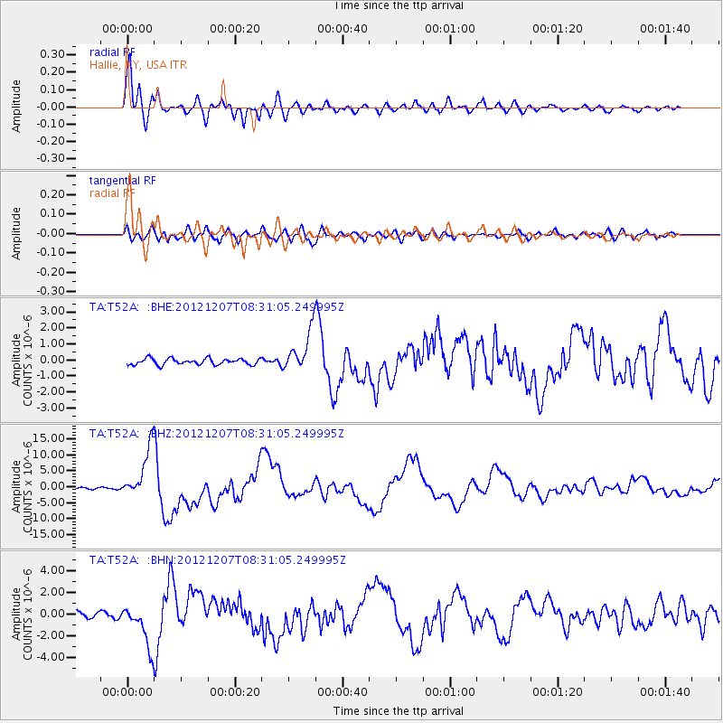
Signal To Noise
| Channel | StoN | STA | LTA |
| TA:T52A: :BHZ:20121207T08:31:05.249995Z | 20.29707 | 8.2097495E-6 | 4.0447955E-7 |
| TA:T52A: :BHN:20121207T08:31:05.249995Z | 4.8402386 | 1.9785064E-6 | 4.0876213E-7 |
| TA:T52A: :BHE:20121207T08:31:05.249995Z | 6.8492165 | 1.3122462E-6 | 1.9159073E-7 |
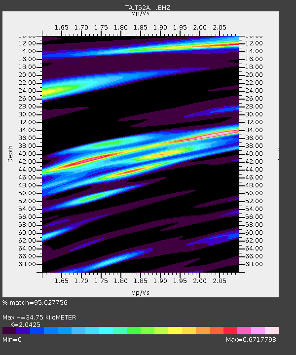
| Arrivals | |
| Ps | 5.7 SECOND |
| PpPs | 16 SECOND |
| PsPs/PpSs | 22 SECOND |

