
S51A Beattyville, KY, USA - Earthquake Result Viewer
| ||||||||||||||||||
| ||||||||||||||||||
| ||||||||||||||||||
|
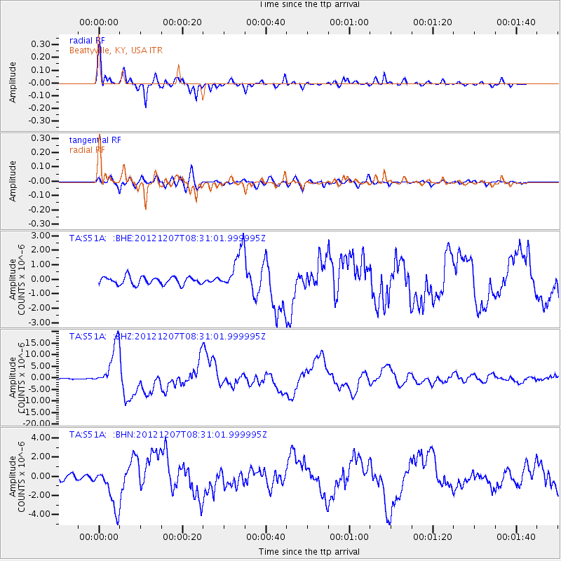
Signal To Noise
| Channel | StoN | STA | LTA |
| TA:S51A: :BHZ:20121207T08:31:01.999995Z | 20.391916 | 9.5971445E-6 | 4.7063475E-7 |
| TA:S51A: :BHN:20121207T08:31:01.999995Z | 6.4501815 | 2.2509792E-6 | 3.489792E-7 |
| TA:S51A: :BHE:20121207T08:31:01.999995Z | 5.44858 | 1.4318804E-6 | 2.6279884E-7 |
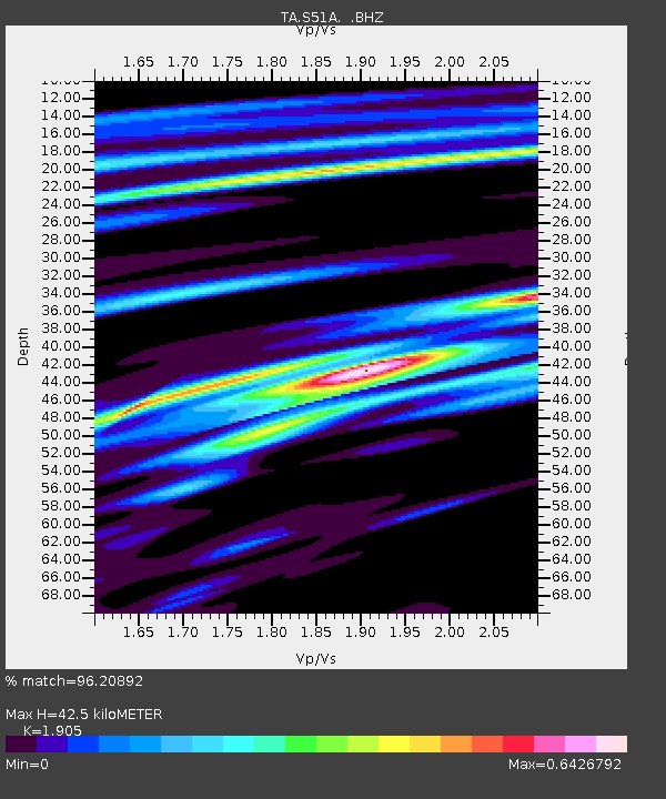
| Arrivals | |
| Ps | 6.1 SECOND |
| PpPs | 19 SECOND |
| PsPs/PpSs | 25 SECOND |

