U51A La Follette, TN, USA - Earthquake Result Viewer
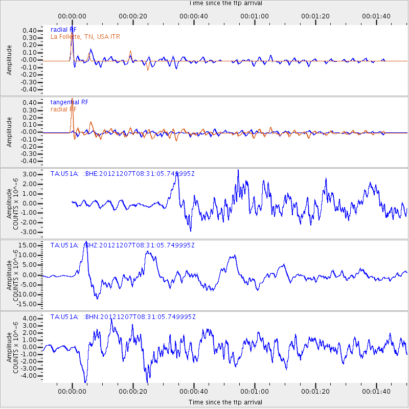
Earthquake location: Off East Coast Of Honshu, Japan
Earthquake latitude/longitude: 37.9/143.9
Earthquake time(UTC): 2012/12/07 (342) 08:18:23 GMT
Earthquake Depth: 31 km
Earthquake Magnitude: 7.2 MB, 7.3 MS, 7.3 MW, 7.3 MW
Earthquake Catalog/Contributor: WHDF/NEIC
Network: TA USArray Transportable Network (new EarthScope stations)
Station: U51A La Follette, TN, USA
Lat/Lon: 36.38 N/84.02 W
Elevation: 472 m
Distance: 93.8 deg
Az: 36.922 deg
Baz: 323.918 deg
Ray Param: 0.041177854
Estimated Moho Depth: 48.5 km
Estimated Crust Vp/Vs: 1.81
Assumed Crust Vp: 6.476 km/s
Estimated Crust Vs: 3.573 km/s
Estimated Crust Poisson's Ratio: 0.28
Radial Match: 95.22898 %
Radial Bump: 400
Transverse Match: 86.69128 %
Transverse Bump: 400
SOD ConfigId: 488671
Insert Time: 2013-03-29 04:49:36.128 +0000
GWidth: 2.5
Max Bumps: 400
Tol: 0.001

Signal To Noise

ChannelStoNSTALTA
TA:U51A: :BHZ:20121207T08:31:05.749995Z22.3356748.3469295E-63.7370393E-7
TA:U51A: :BHN:20121207T08:31:05.749995Z8.6442292.2235877E-62.5723378E-7
TA:U51A: :BHE:20121207T08:31:05.749995Z6.36864381.5803956E-62.4815262E-7
Arrivals
Ps6.2 SECOND
PpPs21 SECOND
PsPs/PpSs27 SECOND