S50A Richmond, KY, USA - Earthquake Result Viewer
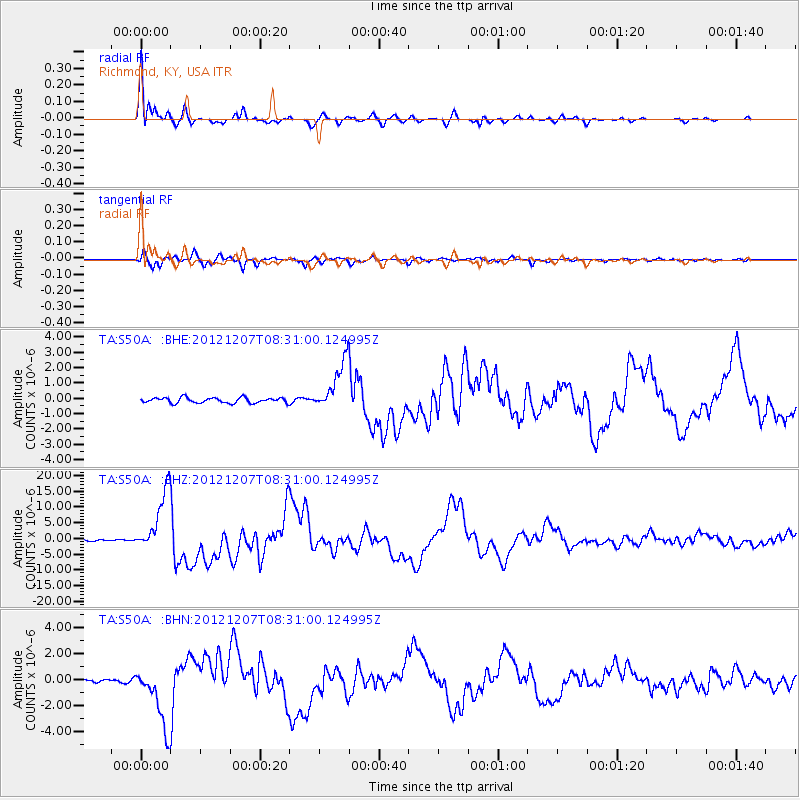
Earthquake location: Off East Coast Of Honshu, Japan
Earthquake latitude/longitude: 37.9/143.9
Earthquake time(UTC): 2012/12/07 (342) 08:18:23 GMT
Earthquake Depth: 31 km
Earthquake Magnitude: 7.2 MB, 7.3 MS, 7.3 MW, 7.3 MW
Earthquake Catalog/Contributor: WHDF/NEIC
Network: TA USArray Transportable Network (new EarthScope stations)
Station: S50A Richmond, KY, USA
Lat/Lon: 37.68 N/84.40 W
Elevation: 300 m
Distance: 92.6 deg
Az: 36.403 deg
Baz: 323.717 deg
Ray Param: 0.041421205
Estimated Moho Depth: 10.75 km
Estimated Crust Vp/Vs: 1.86
Assumed Crust Vp: 6.476 km/s
Estimated Crust Vs: 3.486 km/s
Estimated Crust Poisson's Ratio: 0.30
Radial Match: 98.39141 %
Radial Bump: 339
Transverse Match: 94.88359 %
Transverse Bump: 400
SOD ConfigId: 488671
Insert Time: 2013-03-29 04:49:47.251 +0000
GWidth: 2.5
Max Bumps: 400
Tol: 0.001

Signal To Noise

ChannelStoNSTALTA
TA:S50A: :BHZ:20121207T08:31:00.124995Z52.4032639.676944E-61.84663E-7
TA:S50A: :BHN:20121207T08:31:00.124995Z18.3574662.4116314E-61.313706E-7
TA:S50A: :BHE:20121207T08:31:00.124995Z9.4954961.6222845E-61.708478E-7
Arrivals
Ps1.5 SECOND
PpPs4.7 SECOND
PsPs/PpSs6.1 SECOND