O50A Cable, OH, USA - Earthquake Result Viewer
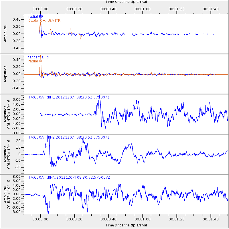
Earthquake location: Off East Coast Of Honshu, Japan
Earthquake latitude/longitude: 37.9/143.9
Earthquake time(UTC): 2012/12/07 (342) 08:18:23 GMT
Earthquake Depth: 31 km
Earthquake Magnitude: 7.2 MB, 7.3 MS, 7.3 MW, 7.3 MW
Earthquake Catalog/Contributor: WHDF/NEIC
Network: TA USArray Transportable Network (new EarthScope stations)
Station: O50A Cable, OH, USA
Lat/Lon: 40.15 N/83.62 W
Elevation: 399 m
Distance: 90.9 deg
Az: 34.461 deg
Baz: 324.265 deg
Ray Param: 0.041633915
Estimated Moho Depth: 69.75 km
Estimated Crust Vp/Vs: 1.65
Assumed Crust Vp: 6.498 km/s
Estimated Crust Vs: 3.932 km/s
Estimated Crust Poisson's Ratio: 0.21
Radial Match: 98.14199 %
Radial Bump: 400
Transverse Match: 86.52558 %
Transverse Bump: 400
SOD ConfigId: 488671
Insert Time: 2013-03-29 04:50:20.958 +0000
GWidth: 2.5
Max Bumps: 400
Tol: 0.001

Signal To Noise

ChannelStoNSTALTA
TA:O50A: :BHZ:20121207T08:30:52.575007Z61.8274461.2440171E-52.0120791E-7
TA:O50A: :BHN:20121207T08:30:52.575007Z14.4760573.4130169E-62.3576978E-7
TA:O50A: :BHE:20121207T08:30:52.575007Z12.683883.0892047E-62.4355361E-7
Arrivals
Ps7.2 SECOND
PpPs28 SECOND
PsPs/PpSs35 SECOND