N50A Nevada, OH, USA - Earthquake Result Viewer
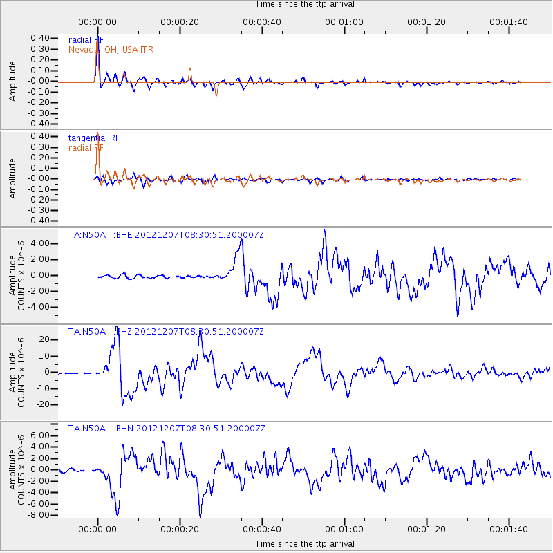
Earthquake location: Off East Coast Of Honshu, Japan
Earthquake latitude/longitude: 37.9/143.9
Earthquake time(UTC): 2012/12/07 (342) 08:18:23 GMT
Earthquake Depth: 31 km
Earthquake Magnitude: 7.2 MB, 7.3 MS, 7.3 MW, 7.3 MW
Earthquake Catalog/Contributor: WHDF/NEIC
Network: TA USArray Transportable Network (new EarthScope stations)
Station: N50A Nevada, OH, USA
Lat/Lon: 40.77 N/83.15 W
Elevation: 277 m
Distance: 90.6 deg
Az: 33.805 deg
Baz: 324.578 deg
Ray Param: 0.041655168
Estimated Moho Depth: 14.25 km
Estimated Crust Vp/Vs: 2.07
Assumed Crust Vp: 6.498 km/s
Estimated Crust Vs: 3.139 km/s
Estimated Crust Poisson's Ratio: 0.35
Radial Match: 97.743034 %
Radial Bump: 365
Transverse Match: 94.06452 %
Transverse Bump: 400
SOD ConfigId: 488671
Insert Time: 2013-03-29 04:50:42.816 +0000
GWidth: 2.5
Max Bumps: 400
Tol: 0.001

Signal To Noise

ChannelStoNSTALTA
TA:N50A: :BHZ:20121207T08:30:51.200007Z47.569631.2279783E-52.5814336E-7
TA:N50A: :BHN:20121207T08:30:51.200007Z10.3390633.0512888E-62.9512236E-7
TA:N50A: :BHE:20121207T08:30:51.200007Z10.9938671.8245062E-61.6595672E-7
Arrivals
Ps2.4 SECOND
PpPs6.6 SECOND
PsPs/PpSs9.0 SECOND