O48A Farmland, IN, USA - Earthquake Result Viewer
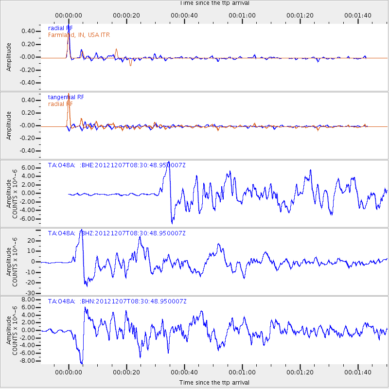
Earthquake location: Off East Coast Of Honshu, Japan
Earthquake latitude/longitude: 37.9/143.9
Earthquake time(UTC): 2012/12/07 (342) 08:18:23 GMT
Earthquake Depth: 31 km
Earthquake Magnitude: 7.2 MB, 7.3 MS, 7.3 MW, 7.3 MW
Earthquake Catalog/Contributor: WHDF/NEIC
Network: TA USArray Transportable Network (new EarthScope stations)
Station: O48A Farmland, IN, USA
Lat/Lon: 40.26 N/85.16 W
Elevation: 300 m
Distance: 90.2 deg
Az: 35.344 deg
Baz: 323.269 deg
Ray Param: 0.041689824
Estimated Moho Depth: 33.5 km
Estimated Crust Vp/Vs: 1.85
Assumed Crust Vp: 6.498 km/s
Estimated Crust Vs: 3.507 km/s
Estimated Crust Poisson's Ratio: 0.29
Radial Match: 98.58614 %
Radial Bump: 284
Transverse Match: 90.89973 %
Transverse Bump: 400
SOD ConfigId: 488671
Insert Time: 2013-03-29 04:50:52.984 +0000
GWidth: 2.5
Max Bumps: 400
Tol: 0.001

Signal To Noise

ChannelStoNSTALTA
TA:O48A: :BHZ:20121207T08:30:48.950007Z72.541961.5212778E-52.0971004E-7
TA:O48A: :BHN:20121207T08:30:48.950007Z15.2954564.1825465E-62.7345027E-7
TA:O48A: :BHE:20121207T08:30:48.950007Z25.6862663.7333962E-61.4534601E-7
Arrivals
Ps4.5 SECOND
PpPs14 SECOND
PsPs/PpSs19 SECOND