Q50A Georgetown, OH, USA - Earthquake Result Viewer
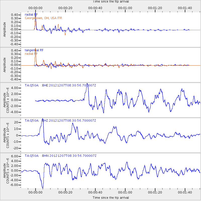
Earthquake location: Off East Coast Of Honshu, Japan
Earthquake latitude/longitude: 37.9/143.9
Earthquake time(UTC): 2012/12/07 (342) 08:18:23 GMT
Earthquake Depth: 31 km
Earthquake Magnitude: 7.2 MB, 7.3 MS, 7.3 MW, 7.3 MW
Earthquake Catalog/Contributor: WHDF/NEIC
Network: TA USArray Transportable Network (new EarthScope stations)
Station: Q50A Georgetown, OH, USA
Lat/Lon: 38.84 N/83.98 W
Elevation: 262 m
Distance: 91.8 deg
Az: 35.449 deg
Baz: 324.013 deg
Ray Param: 0.041542277
Estimated Moho Depth: 53.25 km
Estimated Crust Vp/Vs: 1.63
Assumed Crust Vp: 6.232 km/s
Estimated Crust Vs: 3.817 km/s
Estimated Crust Poisson's Ratio: 0.20
Radial Match: 98.823044 %
Radial Bump: 227
Transverse Match: 93.21263 %
Transverse Bump: 400
SOD ConfigId: 488671
Insert Time: 2013-03-29 04:51:02.425 +0000
GWidth: 2.5
Max Bumps: 400
Tol: 0.001

Signal To Noise

ChannelStoNSTALTA
TA:Q50A: :BHZ:20121207T08:30:56.700007Z53.4760671.1420235E-52.1355787E-7
TA:Q50A: :BHN:20121207T08:30:56.700007Z17.7046012.9828427E-61.684784E-7
TA:Q50A: :BHE:20121207T08:30:56.700007Z18.0349312.3779949E-61.3185495E-7
Arrivals
Ps5.5 SECOND
PpPs22 SECOND
PsPs/PpSs28 SECOND