M50A Fremont, OH, USA - Earthquake Result Viewer
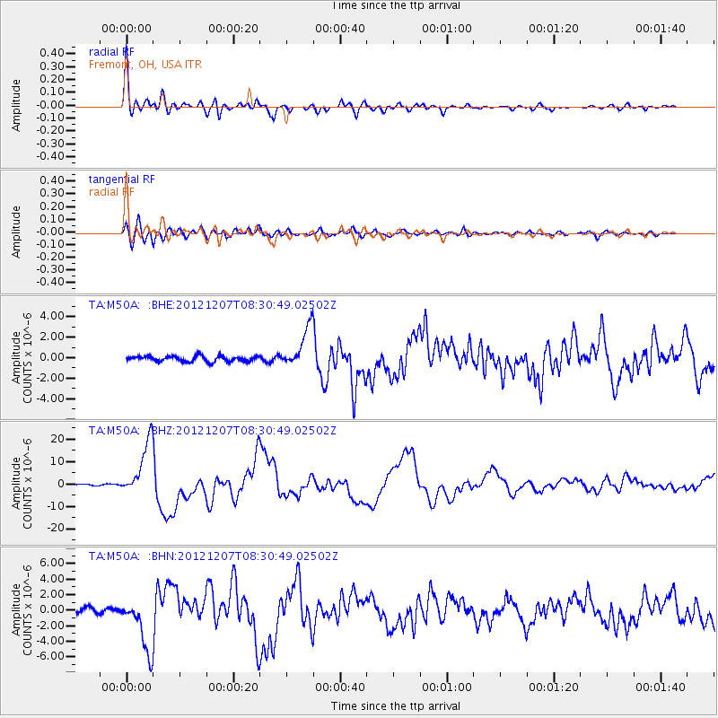
Earthquake location: Off East Coast Of Honshu, Japan
Earthquake latitude/longitude: 37.9/143.9
Earthquake time(UTC): 2012/12/07 (342) 08:18:23 GMT
Earthquake Depth: 31 km
Earthquake Magnitude: 7.2 MB, 7.3 MS, 7.3 MW, 7.3 MW
Earthquake Catalog/Contributor: WHDF/NEIC
Network: TA USArray Transportable Network (new EarthScope stations)
Station: M50A Fremont, OH, USA
Lat/Lon: 41.40 N/83.04 W
Elevation: 176 m
Distance: 90.2 deg
Az: 33.374 deg
Baz: 324.651 deg
Ray Param: 0.0416886
Estimated Moho Depth: 48.75 km
Estimated Crust Vp/Vs: 1.87
Assumed Crust Vp: 6.498 km/s
Estimated Crust Vs: 3.484 km/s
Estimated Crust Poisson's Ratio: 0.30
Radial Match: 96.67002 %
Radial Bump: 400
Transverse Match: 93.098236 %
Transverse Bump: 400
SOD ConfigId: 488671
Insert Time: 2013-03-29 04:51:25.801 +0000
GWidth: 2.5
Max Bumps: 400
Tol: 0.001

Signal To Noise

ChannelStoNSTALTA
TA:M50A: :BHZ:20121207T08:30:49.02502Z35.6430131.23306745E-53.4594927E-7
TA:M50A: :BHN:20121207T08:30:49.02502Z10.5864673.5040437E-63.3099272E-7
TA:M50A: :BHE:20121207T08:30:49.02502Z7.52826932.028714E-62.6947947E-7
Arrivals
Ps6.6 SECOND
PpPs21 SECOND
PsPs/PpSs28 SECOND