L48A N Adams, MI, USA - Earthquake Result Viewer
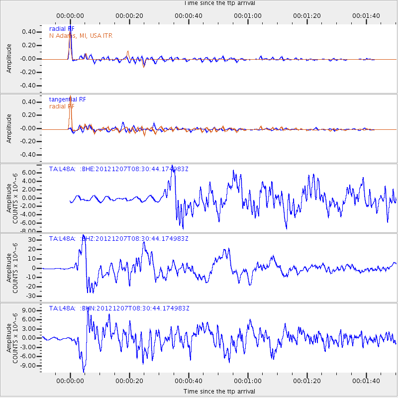
Earthquake location: Off East Coast Of Honshu, Japan
Earthquake latitude/longitude: 37.9/143.9
Earthquake time(UTC): 2012/12/07 (342) 08:18:23 GMT
Earthquake Depth: 31 km
Earthquake Magnitude: 7.2 MB, 7.3 MS, 7.3 MW, 7.3 MW
Earthquake Catalog/Contributor: WHDF/NEIC
Network: TA USArray Transportable Network (new EarthScope stations)
Station: L48A N Adams, MI, USA
Lat/Lon: 41.94 N/84.43 W
Elevation: 369 m
Distance: 89.1 deg
Az: 33.903 deg
Baz: 323.733 deg
Ray Param: 0.042039715
Estimated Moho Depth: 39.5 km
Estimated Crust Vp/Vs: 2.09
Assumed Crust Vp: 6.498 km/s
Estimated Crust Vs: 3.109 km/s
Estimated Crust Poisson's Ratio: 0.35
Radial Match: 98.388626 %
Radial Bump: 386
Transverse Match: 90.68205 %
Transverse Bump: 400
SOD ConfigId: 488671
Insert Time: 2013-03-29 04:51:27.697 +0000
GWidth: 2.5
Max Bumps: 400
Tol: 0.001

Signal To Noise

ChannelStoNSTALTA
TA:L48A: :BHZ:20121207T08:30:44.174983Z48.7888571.567445E-53.212711E-7
TA:L48A: :BHN:20121207T08:30:44.174983Z13.8553144.3324994E-63.1269587E-7
TA:L48A: :BHE:20121207T08:30:44.174983Z7.4497063.1792094E-64.2675637E-7
Arrivals
Ps6.7 SECOND
PpPs18 SECOND
PsPs/PpSs25 SECOND