
M48A Edgerton, OH, USA - Earthquake Result Viewer
| ||||||||||||||||||
| ||||||||||||||||||
| ||||||||||||||||||
|
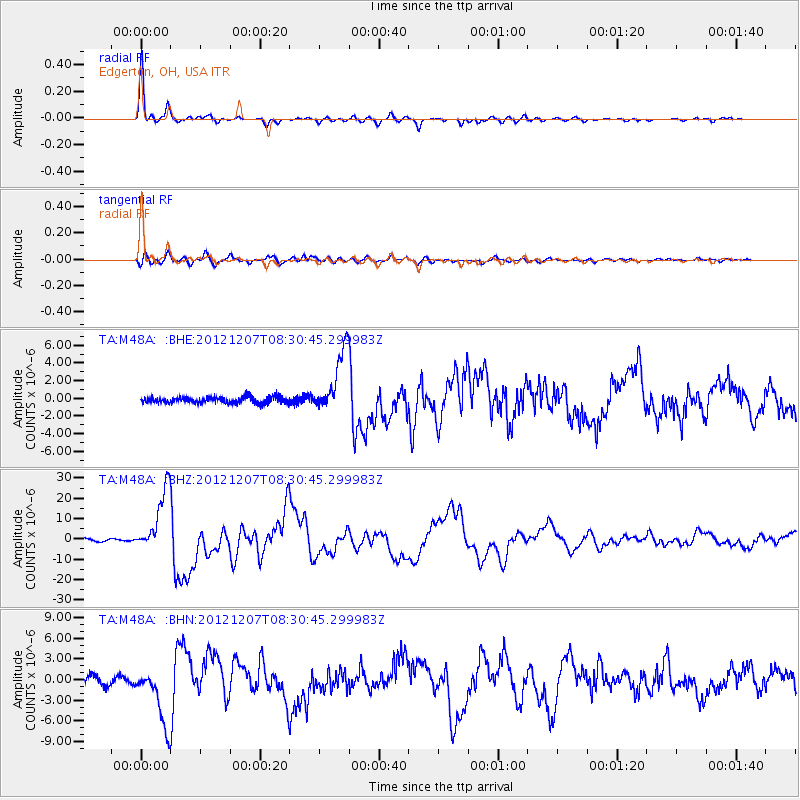
Signal To Noise
| Channel | StoN | STA | LTA |
| TA:M48A: :BHZ:20121207T08:30:45.299983Z | 29.759596 | 1.552082E-5 | 5.2154E-7 |
| TA:M48A: :BHN:20121207T08:30:45.299983Z | 8.306146 | 4.185583E-6 | 5.03914E-7 |
| TA:M48A: :BHE:20121207T08:30:45.299983Z | 9.9382305 | 3.5555674E-6 | 3.5776662E-7 |
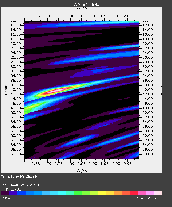
| Arrivals | |
| Ps | 4.7 SECOND |
| PpPs | 17 SECOND |
| PsPs/PpSs | 21 SECOND |

