M51A Elyria, OH, USA - Earthquake Result Viewer
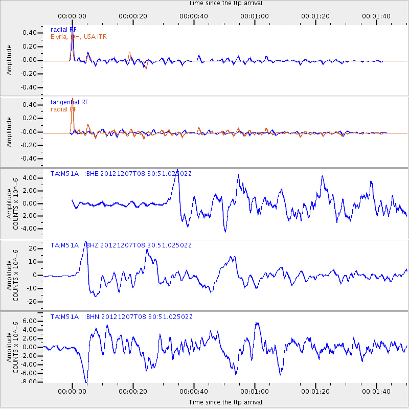
Earthquake location: Off East Coast Of Honshu, Japan
Earthquake latitude/longitude: 37.9/143.9
Earthquake time(UTC): 2012/12/07 (342) 08:18:23 GMT
Earthquake Depth: 31 km
Earthquake Magnitude: 7.2 MB, 7.3 MS, 7.3 MW, 7.3 MW
Earthquake Catalog/Contributor: WHDF/NEIC
Network: TA USArray Transportable Network (new EarthScope stations)
Station: M51A Elyria, OH, USA
Lat/Lon: 41.33 N/82.18 W
Elevation: 239 m
Distance: 90.6 deg
Az: 32.885 deg
Baz: 325.22 deg
Ray Param: 0.041657925
Estimated Moho Depth: 55.0 km
Estimated Crust Vp/Vs: 1.60
Assumed Crust Vp: 6.498 km/s
Estimated Crust Vs: 4.061 km/s
Estimated Crust Poisson's Ratio: 0.18
Radial Match: 98.29004 %
Radial Bump: 331
Transverse Match: 89.90995 %
Transverse Bump: 400
SOD ConfigId: 488671
Insert Time: 2013-03-29 04:52:30.410 +0000
GWidth: 2.5
Max Bumps: 400
Tol: 0.001

Signal To Noise

ChannelStoNSTALTA
TA:M51A: :BHZ:20121207T08:30:51.02502Z54.6135331.2367721E-52.2645891E-7
TA:M51A: :BHN:20121207T08:30:51.02502Z14.2902283.6033537E-62.5215508E-7
TA:M51A: :BHE:20121207T08:30:51.02502Z10.7021752.5565678E-62.3888302E-7
Arrivals
Ps5.2 SECOND
PpPs21 SECOND
PsPs/PpSs27 SECOND