
J45A Montague, MI, USA - Earthquake Result Viewer
| ||||||||||||||||||
| ||||||||||||||||||
| ||||||||||||||||||
|
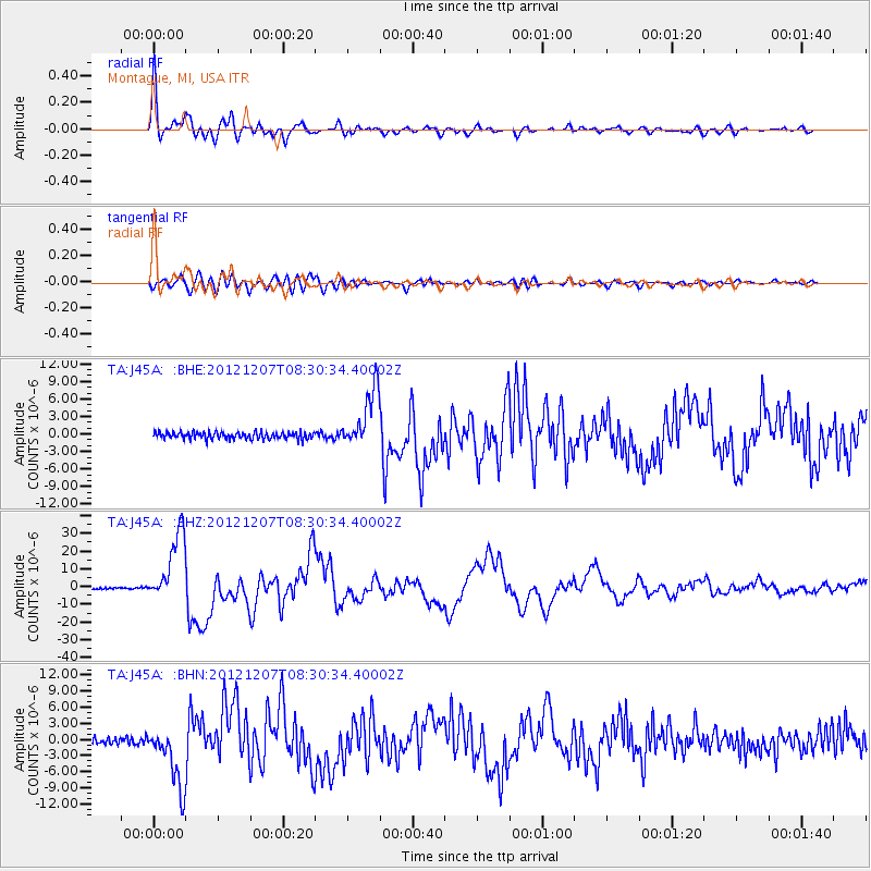
Signal To Noise
| Channel | StoN | STA | LTA |
| TA:J45A: :BHZ:20121207T08:30:34.40002Z | 46.178497 | 1.9805811E-5 | 4.2889687E-7 |
| TA:J45A: :BHN:20121207T08:30:34.40002Z | 7.1116414 | 5.650795E-6 | 7.945838E-7 |
| TA:J45A: :BHE:20121207T08:30:34.40002Z | 8.656772 | 5.047481E-6 | 5.8306733E-7 |
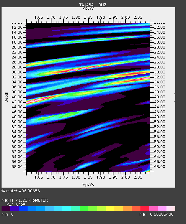
| Arrivals | |
| Ps | 4.1 SECOND |
| PpPs | 16 SECOND |
| PsPs/PpSs | 20 SECOND |

