POKR Poker Plat Research Range, AK, USA - Earthquake Result Viewer
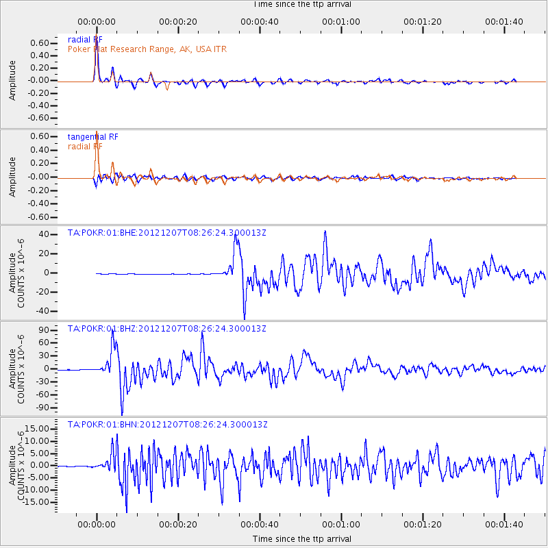
Earthquake location: Off East Coast Of Honshu, Japan
Earthquake latitude/longitude: 37.9/143.9
Earthquake time(UTC): 2012/12/07 (342) 08:18:23 GMT
Earthquake Depth: 31 km
Earthquake Magnitude: 7.2 MB, 7.3 MS, 7.3 MW, 7.3 MW
Earthquake Catalog/Contributor: WHDF/NEIC
Network: TA USArray Transportable Network (new EarthScope stations)
Station: POKR Poker Plat Research Range, AK, USA
Lat/Lon: 65.12 N/147.43 W
Elevation: 501 m
Distance: 47.5 deg
Az: 32.327 deg
Baz: 269.797 deg
Ray Param: 0.069919385
Estimated Moho Depth: 25.25 km
Estimated Crust Vp/Vs: 1.98
Assumed Crust Vp: 6.566 km/s
Estimated Crust Vs: 3.312 km/s
Estimated Crust Poisson's Ratio: 0.33
Radial Match: 97.26217 %
Radial Bump: 277
Transverse Match: 88.389885 %
Transverse Bump: 400
SOD ConfigId: 488671
Insert Time: 2013-03-29 04:53:47.936 +0000
GWidth: 2.5
Max Bumps: 400
Tol: 0.001

Signal To Noise

ChannelStoNSTALTA
TA:POKR:01:BHZ:20121207T08:26:24.300013Z307.022133.4226112E-51.1147767E-7
TA:POKR:01:BHN:20121207T08:26:24.300013Z30.5818163.6703061E-61.2001597E-7
TA:POKR:01:BHE:20121207T08:26:24.300013Z105.684221.6874927E-51.5967309E-7
Arrivals
Ps4.0 SECOND
PpPs11 SECOND
PsPs/PpSs15 SECOND