J01E Myrtle Point, OR, USA - Earthquake Result Viewer
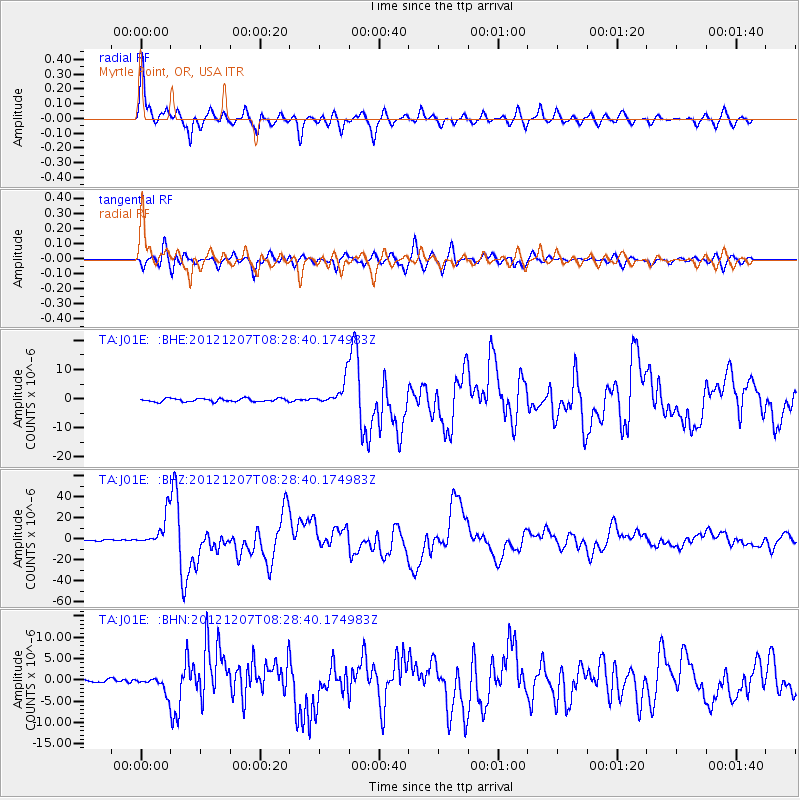
Earthquake location: Off East Coast Of Honshu, Japan
Earthquake latitude/longitude: 37.9/143.9
Earthquake time(UTC): 2012/12/07 (342) 08:18:23 GMT
Earthquake Depth: 31 km
Earthquake Magnitude: 7.2 MB, 7.3 MS, 7.3 MW, 7.3 MW
Earthquake Catalog/Contributor: WHDF/NEIC
Network: TA USArray Transportable Network (new EarthScope stations)
Station: J01E Myrtle Point, OR, USA
Lat/Lon: 43.16 N/123.93 W
Elevation: 128 m
Distance: 66.7 deg
Az: 52.76 deg
Baz: 300.593 deg
Ray Param: 0.057390273
Estimated Moho Depth: 50.0 km
Estimated Crust Vp/Vs: 1.79
Assumed Crust Vp: 6.522 km/s
Estimated Crust Vs: 3.638 km/s
Estimated Crust Poisson's Ratio: 0.27
Radial Match: 95.11373 %
Radial Bump: 400
Transverse Match: 86.82644 %
Transverse Bump: 400
SOD ConfigId: 488671
Insert Time: 2013-03-29 04:54:11.983 +0000
GWidth: 2.5
Max Bumps: 400
Tol: 0.001

Signal To Noise

ChannelStoNSTALTA
TA:J01E: :BHZ:20121207T08:28:40.174983Z22.7428971.4513875E-56.3817174E-7
TA:J01E: :BHN:20121207T08:28:40.174983Z3.38450621.8202112E-65.37807E-7
TA:J01E: :BHE:20121207T08:28:40.174983Z7.6806144.284304E-65.578075E-7
Arrivals
Ps6.3 SECOND
PpPs21 SECOND
PsPs/PpSs27 SECOND