K49A Clarkson, MI, USA - Earthquake Result Viewer
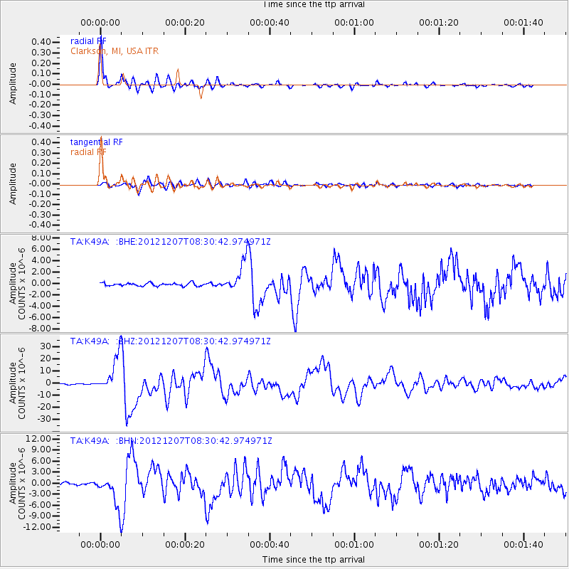
Earthquake location: Off East Coast Of Honshu, Japan
Earthquake latitude/longitude: 37.9/143.9
Earthquake time(UTC): 2012/12/07 (342) 08:18:23 GMT
Earthquake Depth: 31 km
Earthquake Magnitude: 7.2 MB, 7.3 MS, 7.3 MW, 7.3 MW
Earthquake Catalog/Contributor: WHDF/NEIC
Network: TA USArray Transportable Network (new EarthScope stations)
Station: K49A Clarkson, MI, USA
Lat/Lon: 42.78 N/83.46 W
Elevation: 336 m
Distance: 88.9 deg
Az: 32.824 deg
Baz: 324.37 deg
Ray Param: 0.042224802
Estimated Moho Depth: 31.0 km
Estimated Crust Vp/Vs: 1.86
Assumed Crust Vp: 6.483 km/s
Estimated Crust Vs: 3.49 km/s
Estimated Crust Poisson's Ratio: 0.30
Radial Match: 98.274284 %
Radial Bump: 326
Transverse Match: 90.303185 %
Transverse Bump: 400
SOD ConfigId: 488671
Insert Time: 2013-03-29 04:54:21.956 +0000
GWidth: 2.5
Max Bumps: 400
Tol: 0.001

Signal To Noise

ChannelStoNSTALTA
TA:K49A: :BHZ:20121207T08:30:42.974971Z49.2214661.5529411E-53.1550078E-7
TA:K49A: :BHN:20121207T08:30:42.974971Z12.9617024.267304E-63.2922404E-7
TA:K49A: :BHE:20121207T08:30:42.974971Z11.5236872.8807856E-62.4998818E-7
Arrivals
Ps4.2 SECOND
PpPs13 SECOND
PsPs/PpSs18 SECOND